Reading view

UN agency warns El Nino likely by August, raising risk of heatwaves, droughts and extreme weather

Malay Mail

GENEVA, June 2 — There is an 80-per cent chance of the warming El Nino phenomenon developing between June and August, increasing the risk of extreme weather events, the World Meteorological Organization said today. 

“Fuelled by unusually warm ocean waters in the tropical Pacific, El Nino conditions are developing and are set to influence global temperature and rainfall patterns,” the United Nations’ weather and climate agency (WMO) said.

Forecasts from the WMO global network “indicate a pronounced shift toward El Nino conditions, with probabilities reaching 80 percent for June-August”, the Geneva-based organisation said.

El Nino is a natural climate phenomenon that warms surface temperatures in the central and eastern equatorial Pacific Ocean, bringing worldwide changes in winds, pressure and rainfall patterns.

It typically takes place every two to seven years and lasts around nine to 12 months.

Conditions oscillate between El Nino and its opposite La Nina, with neutral conditions in between.

The likelihood of El Nino developing by November is “near or above 90 percent”, and most forecast models suggest it will be “at least moderate—and possibly strong”, the WMO said in its quarterly El Nino/La Nina update.

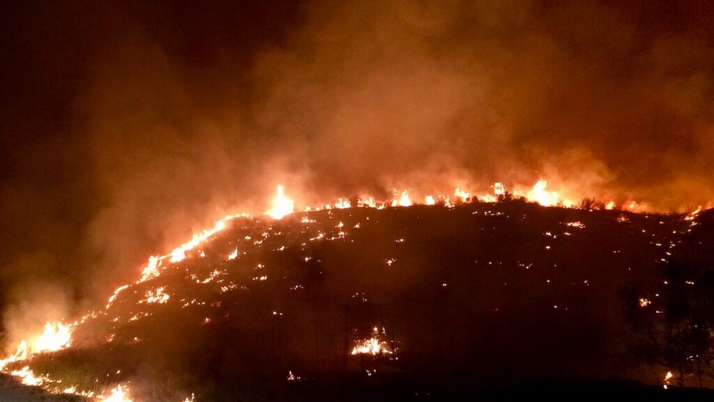
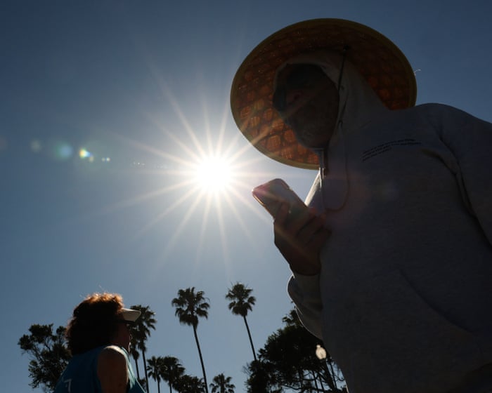
WMO chief Celeste Saulo said the world therefore needed to get ready for an El Nino which could “exacerbate drought and heavy rainfall and increase the risk of heatwaves both on land and in the ocean”.

The WMO says that even a moderate El Nino makes some weather and climate extremes more likely.

The last El Nino contributed to making 2023 the second-hottest year on record and 2024 the all-time high at around 1.55C above the 1850-1900 pre-industrial average.

Urgent climate warning 

In late April to mid-May, the sea-surface temperature in the central-eastern Equatorial Pacific—the area used as a monitoring reference—was approaching El Nino thresholds, the WMO said, with sub-surface temperatures more than 6C above average.

Meanwhile, the Southern Oscillation Index—the atmospheric component of El Nino—is also consistent with El Nino conditions developing.

The WMO said there was no evidence that climate change increases the frequency or intensity of El Nino events.

However, it can amplify the associated impacts, it says, because a warmer ocean and atmosphere increase the availability of energy and moisture for extreme weather events, such as heatwaves and heavy rainfall.

“El Nino is arriving on our doorstep,” UN chief Antonio Guterres said in a video message.

“The world must treat it as the urgent climate warning it is. El Nino conditions will pour fuel on the fire of a warming world. Impacts will hit even harder, travel even farther, and cross borders with devastating speed.

“The only effective response is climate action equal to the crisis—ending the addiction to fossil fuels, accelerating the shift to renewables, protecting the most vulnerable, and delivering early warning systems for all.”

Temperatures above normal 

The WMO said that for June to August, forecasts project “a nearly universal dominance of above normal temperatures in nearly all parts of the globe”.

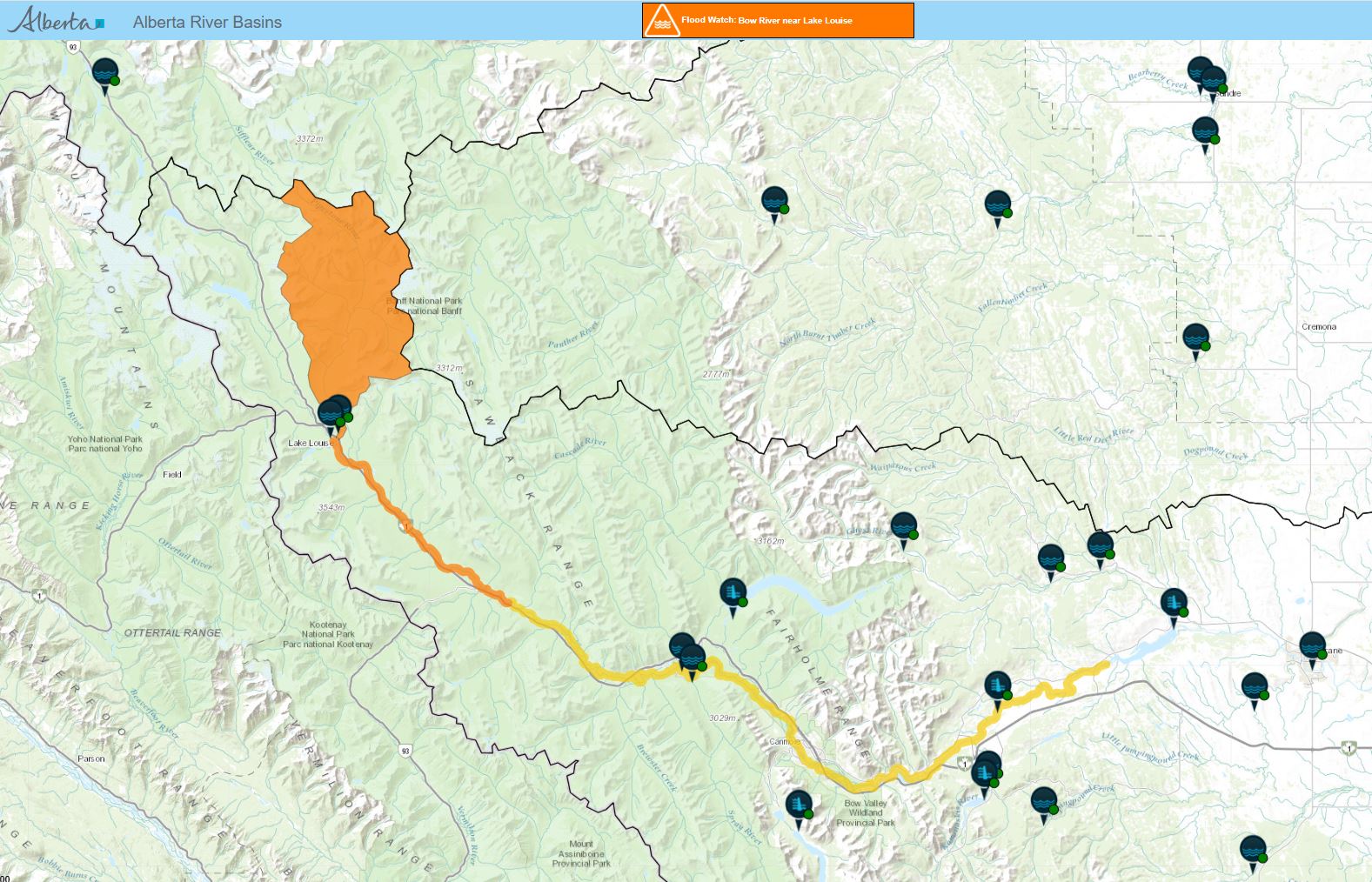
This increases the risk of compounding hazards in some regions, and accelerating the onset of drought conditions where rainfall is reduced, it said.

Regional climate centres are predicting “below-normal” rainfall during the critical June-September rainy season in the northern Greater Horn of Africa; below-average monsoon rainfall in south Asia; and drier and warmer summer conditions in central America.

During the northern hemisphere summer, warm waters associated with El Nino can fuel hurricanes in the central and eastern Pacific, while hindering their development in the Atlantic Ocean.

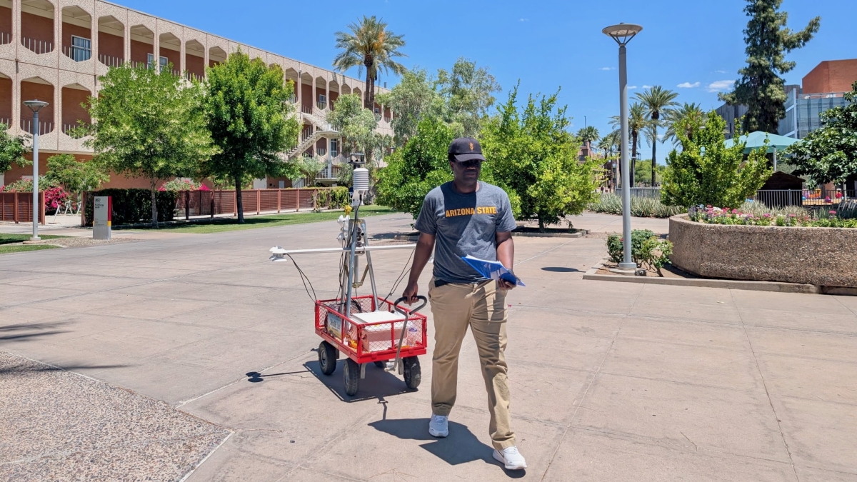
The WMO hopes advance warning will guide preparedness, especially in climate-sensitive sectors like agriculture, water management, energy and health. — AFP


  •  

2026 Has Already Broken Climate Records. El Niño Could Break More.

A wildfire on a hillside burns at night.

Research & Developments is a blog for brief updates that provide context for the flurry of news that impacts science and scientists today.

As the midpoint of the year approaches, several climate records have already been broken. Arctic winter sea ice extent reached a record low. Several countries saw record-breaking winter heat waves. And more than 150 million hectares have already burned globally in wildfires. 

The increasingly likely emergence of an El Niño this summer will likely continue the year’s record-breaking weather trends and could lead to “an unprecedented year of global fire,” according to a statement from World Weather Attribution, a climate research collaboration. 

“In modern human history, we’ve never experienced a strong or very strong El Niño event amid pre-existing conditions that were this warm globally.”

NOAA’s Climate Prediction Center predicts there is a 61% chance of El Niño—a natural climate pattern that involves warming waters in the Pacific Ocean—emerging by July 2026 and persisting through the end of the year. El Niño typically temporarily boosts global temperatures. 

At a press briefing on 11 May hosted by World Weather Attribution, climate scientists outlined the potential risks of this emerging El Niño against the backdrop of human-caused climate change, including intensifying wildfire seasons, extreme heat waves, and worsening droughts.

In the press briefing, Frederike Otto, a climate scientist at World Weather Attribution and Imperial College London, emphasized that climate change will likely play a larger role in the rest of this year’s extreme weather events than El Niño will, pointing to more than 100 analyses done by World Weather Attribution that have controlled for the effects of the El Niño Southern Oscillation (ENSO), the broader climate phenomenon that produces El Niño and its sister condition, La Niña. 

 
Related

•  Read About the 2024 El Niño: Record-Breaking Temperatures Likely as El Niño Persists
 

“We find that human-induced climate change has a much greater influence on the likelihood and intensity of extreme weather events than ENSO,” she said. 

Still, El Niño could push average global temperatures to extremes. The effects of El Niño will “be amplified considerably by the now nearly 1.5°C [(2.7°F)] of global warming experienced as of 2026,” Daniel Swain, a climate scientist at the University of California, Los Angeles and the California Institute for Water Resources, said in a statement. “In modern human history, we’ve never experienced a strong or very strong El Niño event amid pre-existing conditions that were this warm globally.”

The global fire season has “got off to a very fast start,” particularly in the African savanna, Southeast Asia, and northeastern China, Theodore Keeping, who studies extreme weather and wildfires at Imperial College London and World Weather Attribution, said in the briefing. Though El Niño may have mixed effects on the U.S. wildfire season, much of the U.S. is expected to face elevated wildfire risk, and a strong El Niño could worsen wildfires elsewhere in the world, particularly in the Amazon rainforest and Australia, Keeping said. 

More than 150 million hectares have burned in wildfires so far this year. Credit: Our World in Data, CC BY

“This rapid start [to the wildfire season], in combination with the forecast El Niño, means that we’re looking at a particularly severe year materializing,” Keeping said. “The likelihood of harmful, extreme fires potentially could be the highest we’ve seen in recent history.”

—Grace van Deelen (@gvd.bsky.social), Staff Writer

These updates are made possible through information from the scientific community. Do you have a story about science or scientists? Send us a tip at eos@agu.org.

A photo of a hand holding a copy of an issue of Eos appears in a circle over a field of blue along with the Eos logo and the following text: Support Eos’s mission to broadly share science news and research. Below the text is a darker blue button that reads “donate today.”
Text © 2026. AGU. CC BY-NC-ND 3.0
Except where otherwise noted, images are subject to copyright. Any reuse without express permission from the copyright owner is prohibited.
  •  

‘Super El Niño’ is officially here, scientists say. What can we expect?

Experts say climate pattern could supercharge extreme weather events and push temperatures to record highs

EL Niño has officially arrived, US officials at the National Oceanic and Atmospheric Administration (Noaa) said on Thursday, and scientists predict it could be the strongest of the century.

Forecasters had previously anticipated that a phenomenon known as a super “El Niño” would emerge this summer – supercharging extreme weather events and pushing global temperatures to record heights.

Continue reading...

© Photograph: Patrick T Fallon/AFP/Getty Images

© Photograph: Patrick T Fallon/AFP/Getty Images

© Photograph: Patrick T Fallon/AFP/Getty Images

  •  

Atmos Is a Weather App By Photographers, for Photographers

Four smartphone screens display an astronomy app showing forecasts for the Milky Way, aurora, golden hour, and moonrise, each with vivid background images and forecast ratings at the bottom.

As photographers know, light is extremely important. And for outdoor photographers, nothing affects the quality of light quite like the weather. Photographer Matthew Raifman wanted to build a weather app for people like him, photographers who want to know not just what the weather forecast is, but whether or not the conditions will be any good for photography. Enter Atmos for Weather & Photo, also known as Atmos.

[Read More]

  •  

Hottest day of the year ushers in 9 days of rain, as Hong Kong logs over 6,000 instances of lightning on Friday

hko

Hongkongers sweated through the hottest day of the year on Friday, with the Observatory (HKO) recording a maximum temperature of 34.6 degrees Celsius at its headquarters.

Yung Shue Wan, Lamma Island on Friday, June 5.
Yung Shue Wan, Lamma Island on Friday, June 5, 2026. Photo: HKFP.

The mercury neared 37 degrees Celsius in the northern part of the territory.

Maximum temperatures in Hong Kong on June 5, 2026.
Maximum temperatures in Hong Kong on June 5, 2026. Photo: HKO.

Meanwhile, the Observatory noted 1,263 instances of cloud-to-ground lightning on Friday, and 4,859 cases of cloud-to-cloud lightning.

The city is now set to see nine days of rain, the weather service predicts.

See also: How Hong Kong’s elderly face deadly heat inside cramped cage homes

Cloud-to-ground lightning count distribution.
Cloud-to-ground lightning count distribution on June 6, 2026. Photo: HKO.

“A broad trough of low pressure will linger over the vicinity of the coast of southern China to the northern part of the South China Sea during the weekend to midweek next week,” the Observatory said.

The amber rainstorm warning was raised at 10am on Saturday as violent gusts swept into the territory, raising the risk of flooding.

See also: NGO warns hot weather can worsen air quality, urges gov’t action on pollutants and cooling measures in hot districts

Climate crisis

Friday marked the hottest “Grain in Ear” solar term ever documented. The ninth traditional solar term, known in Chinese as Mangzhong, signifies a period when awny crops like wheat are ready to harvest.

This week, environmental NGO Friends of the Earth urged the Hong Kong government to prioritise the climate crisis and strengthen its climate adaptation policies, with the city expected to endure an extremely hot summer.

A heatwave in Hong Kong in late May 2026. Photo: Kyle Lam/HKFP.

The Intergovernmental Panel on Climate Change has warned that the intensity and frequency of heatwaves have continued to increase since the 1950s due to human-caused climate change. The prevalence of greenhouse gases like carbon dioxide – which trap heat in the atmosphere – raises the planet’s surface temperature, with hotter, longer heatwaves putting lives at risk.

See also: How extreme heat became the deadliest silent killer among world weather disasters

Hong Kong has already warmed by 1.7 degrees Celsius since the Industrial Revolution, research NGO Berkeley Earth says. Heat and humidity may reach lethal levels for protracted periods by the end of the century, according to a 2023 study, making it impossible to stay outdoors in some parts of the world.

  •  

Arizona students design app that calculates least-sweaty walking route

It’s not unheard of for standard navigation apps to map out a less-than-ideal pedestrian journey. You technically can walk under that bridge and cross that six-lane highway, but that doesn’t mean you want to. The app doesn’t take into account your safety, nor your comfort in steamy weather. Now, a team at Arizona State University (ASU) is developing a tool to tackle the latter aspect of the problem.

The aptly-called Cool Routes is an online navigation system that calculates sun exposure and mean radiant temperatures to suggest cooler (in the temperature sense) pedestrian routes. A radiant temperature measurement represents the total heat load one experiences in a particular spot. The measurement takes elements like sun exposure and reflected heat into account to better describe just how hot a space will be. 

The mean radiant temperature in Phoenix in the sun can go over 150 degrees Fahrenheit, but decrease to under 100 degrees in the shade. Cool Routes updates its data hourly based on meteorological forecasts and also takes into account buildings and trees. 

“Cool Routes is a website running on a server, and anybody can use it. A user can open it in a browser, pick where they want to start and where they want to go on the ASU Tempe campus, and see walking routes that account for heat exposure,” Ariane Middel, director of ASU’s SHaDE Lab, tells Popular Science. “It looks like a navigation map, but with a heat layer added. Instead of only asking, ‘What is the shortest way to get there?’ Cool Routes also asks, ‘What is the cooler way to get there?’” 

a man walks with an air temperature measuring device in a wagon
To validate the predicted heat loads, researchers used MaRTy, a rolling instrument station that measures human thermal exposure and other meteorological data. Image: Ariane Middel/Arizona State University.

During tests spanning 12 days and different seasons on ASU’s Tempe Campus, Cool Routes successfully found cooler routes over 70 percent of the time, including during mornings and evenings, when there’s usually less of a difference in heat loads between shaded and sunny areas. These paths decreased the perceived heat load by around 4.5 degrees on average. 

To confirm Cool Route’s heat exposure estimates, the team also used a rolling instrument station that measures human thermal exposure among other data., Their results were significantly accurate. Middel and her colleagues describe their work in a study recently published in the journal Building and the Environment

“One of the main things we found is that people often do not need to take a very large detour to reduce their heat exposure. In many cases, a slightly longer route can be substantially more shaded compared with the shortest route,” Middel explains. 

“I would definitely walk 10 extra minutes to get more shade and protect myself from UV exposure. But everyone makes that decision differently,” says Waqar Khan, an ASU computer scientist and co-author of the study. “Some people may choose the cooler route, while others may prefer the shortest one. That is why, in our application, we show both the shortest and coolest routes, along with the route length, estimated walking time, and expected heat exposure.”

Cool Routes currently only works for ASU’s Tempe Campus, but the approach can be applied to identify pedestrian paths in other areas, including cities. What’s more, the researchers believe that Cool Routes data could help city planners find the best places for shade solutions, and even test out potential future cooling strategies via heat load simulations. 


Moving forward, the team, including ASU computer science student and co-author Fletcher Emmott, aims to increase the tool’s accessibility with a Cool Routes mobile application as a part of Emmott’s honors thesis. 

The post Arizona students design app that calculates least-sweaty walking route appeared first on Popular Science.

  •  

Judge Blocks NSF From Dismantling NCAR

The National Center for Atmospheric Research Building is seen on a snowy day, with the roads leading to it cleared, a few cars in the parking lot, and mountains just behind the building.

Research & Developments is a blog for brief updates that provide context for the flurry of news regarding law and policy changes that impact science and scientists today.

A Colorado judge has granted a preliminary injunction to the University Corporation for Atmospheric Research (UCAR). The move temporarily blocks the federal government from moving forward with one part of its effort to dismantle UCAR’s National Center for Atmospheric Research (NCAR) by transferring stewardship of a state-of-the-art supercomputing facility.

Together, UCAR—a nonprofit consortium of universities and colleges—and the National Science Foundation (NSF) operate and maintain the NCAR-Wyoming Supercomputing Center (NWSC) in Cheyenne, Wyo. The facility provides scientists with enormous computational power necessary to run sophisticated analyses of weather, climate, and other Earth systems.

In February, as another step in a chain of actions taken to dismantle NCAR, the NSF informed UCAR and NCAR that it would transfer management and operations of NWSC to a third-party operator.

In turn, UCAR filed a lawsuit alleging that the action violated federal law under the Administrative Procedure Act (APA). To halt NSF’s action under the act, the agency’s attempt to remove UCAR’s stewardship of the facility must be shown to be “arbitrary, capricious, an abuse of discretion, or otherwise not in accordance with law.”

Judge Richard Brooke Jackson of the U.S. District Court for the District of Colorado wrote in a 1 June court order that the action was both arbitrary and capricious “for at least two reasons.” First, NSF didn’t offer an explanation for its decision, and second, it didn’t follow an outlined process to consider public feedback.

The decision means that UCAR will temporarily retain its stewardship of NWSC. 

“NSF’s failure to provide any explanation for its decision—let alone a reasonable one—thwarts meaningful judicial review and renders the challenged action arbitrary and capricious,” Jackson wrote.

He went on to note that efforts to transfer stewardship of UCAR assets, including the supercomputing center, to other institutions, pose the risk of “irreparable harm” to UCAR. One of the chief harms would be brain drain, the judge noted multiple times, writing that “UCAR cannot easily replace employees with the level of education, specialized training, and institutional knowledge necessary to operate and maintain the NWSC’s ‘highly integrated, high-performance supercomputing system.'”

In addition to brain drain, Jackson cited financial injuries to UCAR that would be “difficult, if not impossible” to quantify, as well as an overall threat to the consortium’s mission.

“Any degradation in forecasting, modeling, or related scientific capabilities carries real-world consequences, including potential harm to property and human life. Given those stakes, the public interest strongly favors maintaining the status quo unless and until NSF demonstrates that its transfer decision complies with the APA,” he concluded.

In a statement posted to the UCAR website, the consortium’s interim president, Eric Barron, said UCAR was pleased that Judge Jackson recognized how harmful the proposed transfer would be for the the nation’s scientific enterprise.

“UCAR’s top priority is to advance Earth system science in service to society,” he wrote. “Today’s decision ensures that the NWSC will be able to continue its vital work on behalf of the United States and its stakeholders without interruption.”

—Grace van Deelen (@gvd.bsky.social), Staff Writer, and Emily Gardner, (@emfurd.bsky.social), Associate Editor

These updates are made possible through information from the scientific community. Do you have a story about how changes in law or policy are affecting scientists or research? Send us a tip at eos@agu.org.

A photo of a hand holding a copy of an issue of Eos appears in a circle over a field of blue along with the Eos logo and the following text: Support Eos’s mission to broadly share science news and research. Below the text is a darker blue button that reads “donate today.”
Text © 2026. AGU. CC BY-NC-ND 3.0
Except where otherwise noted, images are subject to copyright. Any reuse without express permission from the copyright owner is prohibited.
  •  
❌