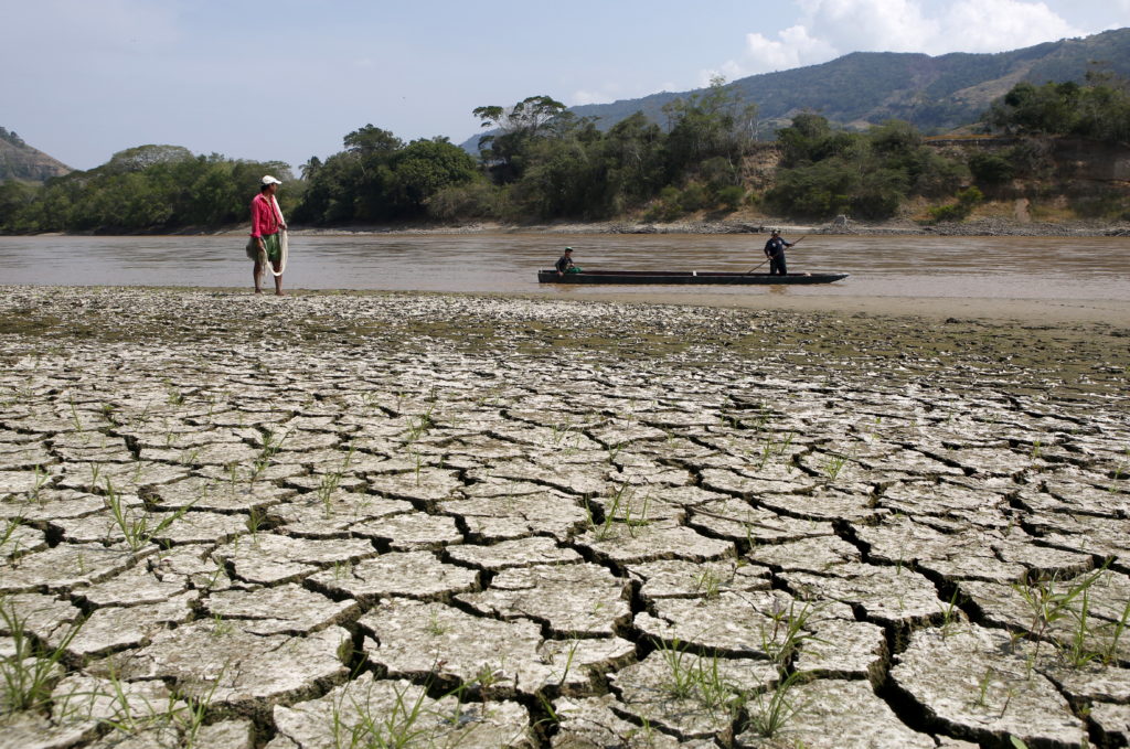
The National Weather Service said it received more than a dozen reports of tornadoes Wednesday across northern Missouri, Iowa, Kansas and Illinois. Trees and utility wires were reported down across the region.
The National Weather Service said it received more than a dozen reports of tornadoes Wednesday across northern Missouri, Iowa, Kansas and Illinois. Trees and utility wires were reported down across the region.
In November 2025, Cyclone Senyar generated extreme rainfall in parts of Sumatra, Indonesia, triggering thousands of landslides. Our new paper in the journal Current Biology demonstrates that these landslides might have a devastating impact on a critically endangered population of Tapanuli orangutan.
In November 2025, Cyclone Senyar brought extreme rainfall to large parts of Sumatra in Indonesia. I have written about this on previous occasions – the rainfall triggered vast numbers of lan
In November 2025, Cyclone Senyar generated extreme rainfall in parts of Sumatra, Indonesia, triggering thousands of landslides. Our new paper in the journal Current Biology demonstrates that these landslides might have a devastating impact on a critically endangered population of Tapanuli orangutan.
In my line of work, we often focus on the landslide impacts on the landscape, on human lives and on infrastructure. We rarely consider the impacts on th eanimal population. This is certainly a weakness that the Cyclone Senyar event brings to focus.
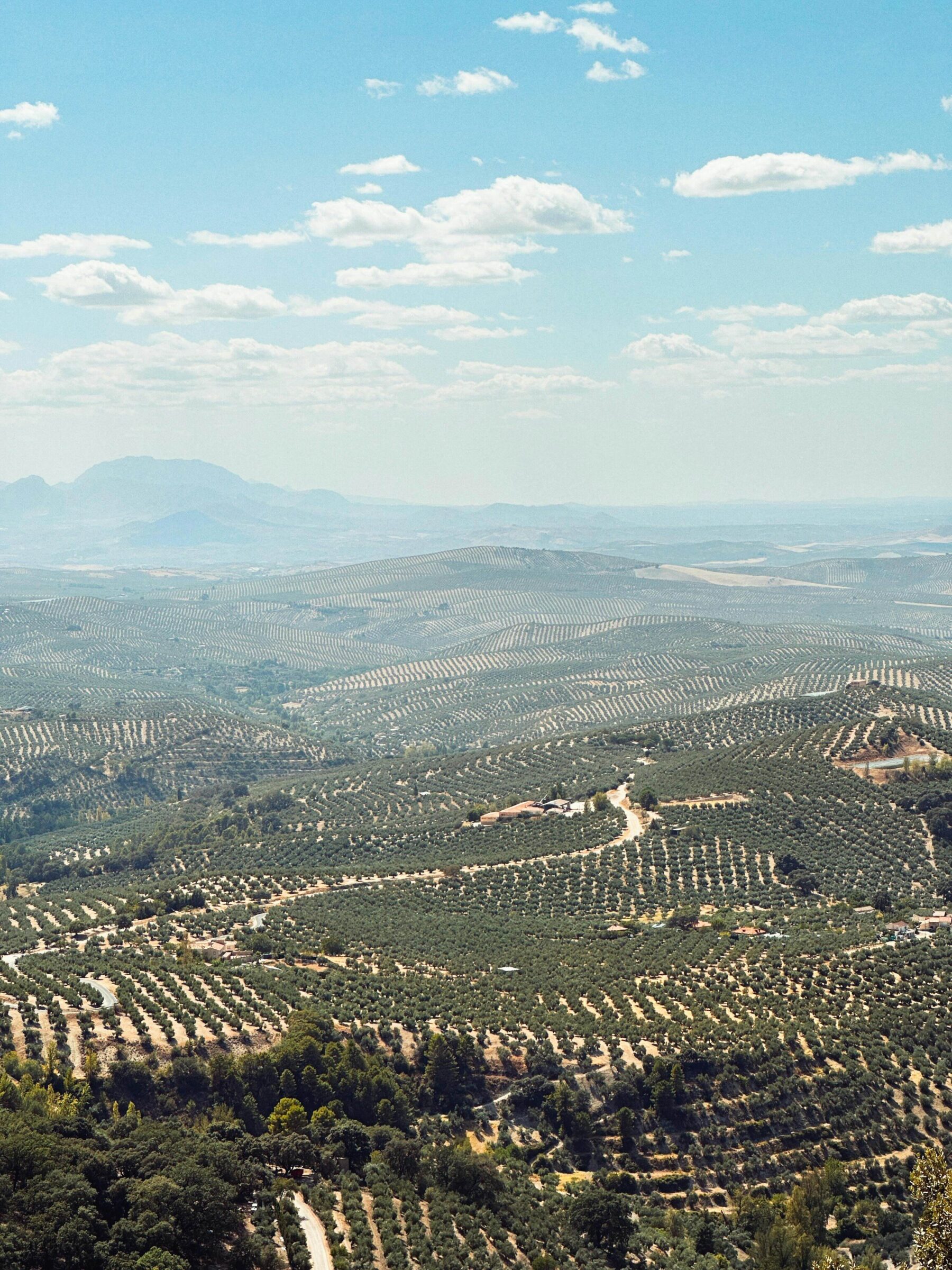
Part of the area devastated by the landslides is that slopes around the Batang Toru rover, an area of forest that is home to a rare species of orangutang. These great apes, Pongo tapanuliensis, live in a habitat known as the West Block of Tapanuli. There are only 800 individuals left in the wild, a situation that is highly precarious. The loss of even a small number of adults could tip the species towards extinction.
I was a part of a consortium of scientists that considered the landslide impacts of Cyclone Senyar on the habitat of these orangutangs. The results have just been published in the journal Current Biology (Meijaard et al. 2026) – the paper is open access and published under a creative commons license.
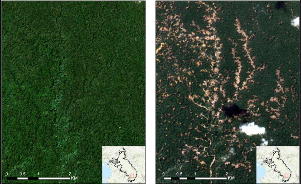
This image, from the paper, shows the landslide impacts of Cyclone Senyar:-
Before and after satellite imagery of the impacts of Cyclone Senyar. From: Meijaard et al. (2026).
In the study area of 71,161 hectares, the mapping indicates that there were 50, 185 individual landslides, covering a surface area of 8,303 hectares. This is about 11% of the forested area. We then estimate the likely loss of the orangutang population, which is likely to be in the range of 18-120 individuals, with a central estimate of 58 individuals. This is likely to have been a devastating loss for this highly endangered population.
This level of habitat loss might also be placing a severe pressure on the remaining population, so further fatalities are very possible through, for example, reduced food availability.
The intensity of the rainfall was almost certainly supercharged by climate change. The impacts of Cyclone Senyar are being replicated widely – and of course we are now in the northern hemisphere tropical cyclone season again.
Our paper makes some policy recommendations for this population of orangutans. First, the government of Indonesia needs to permanently protect this area of forest against mining , palm oil and hydropower developments. Ideally, the protected area should be expanded. Second, Indonesia needs support for biodiversity-recovery, hazard forecasting and ecological restoration planning.
With matches in 16 cities across the US, Mexico and Canada, players and fans face an array of weather-related challengesWith the 2026 World Cup now under way, all 48 teams face a common opposition: summer weather across North America. Matches will be played in 16 cities, from southern Mexico to Canada, with a range of weather risks possible at each venue.Thunderstorms disrupted play before the tournament had even begun. England’s warm-up against Costa Rica in Orlando was delayed by about an hour
With matches in 16 cities across the US, Mexico and Canada, players and fans face an array of weather-related challenges
With the 2026 World Cup now under way, all 48 teams face a common opposition: summer weather across North America. Matches will be played in 16 cities, from southern Mexico to Canada, with a range of weather risks possible at each venue.
Thunderstorms disrupted play before the tournament had even begun. England’s warm-up against Costa Rica in Orlando was delayed by about an hour after storms brought lightning and heavy rain that waterlogged the pitch. Safety regulations at US venues mean play is suspended when lightning is recorded within roughly 8 miles of a stadium, not resuming until 30 minutes after the last strike.
A Guardian analysis reveals how most of 39 countries facing US entry restrictions are most vulnerable environmentally‘Every day it’s more barriers’: how the US is shutting out climate refugeesDonald Trump’s immigration crackdown is largely targeting people from the countries most vulnerable to displacement from climate-driven disasters, a Guardian analysis shows.As the Trump administration pushes policies to boost planet-heating fossil fuels, millions of people are being forced to flee their hom
Donald Trump’s immigration crackdown is largely targeting people from the countries most vulnerable to displacement from climate-driven disasters, a Guardian analysis shows.
As the Trump administration pushes policies to boost planet-heating fossil fuels, millions of people are being forced to flee their homelands due to storms, floods and droughts worsened by the climate crisis.
Research & Developments is a blog for brief updates that provide context for the flurry of news that impacts science and scientists today.
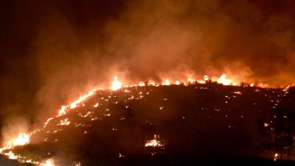
As the midpoint of the year approaches, several climate records have already been broken. Arctic winter sea ice extent reached a record low. Several countries saw record-breaking winter heat waves. And more than 150 million hectares have already burned globally in wildfires.
The increasingly likely emergence of an El Niño this summer will like
Research & Developments is a blog for brief updates that provide context for the flurry of news that impacts science and scientists today.
As the midpoint of the year approaches, several climate records have already been broken. Arctic winter sea ice extent reached a record low. Several countries saw record-breaking winter heat waves. And more than 150 million hectares have already burned globally in wildfires.
The increasingly likely emergence of an El Niño this summer will likely continue the year’s record-breaking weather trends and could lead to “an unprecedented year of global fire,” according to a statement from World Weather Attribution, a climate research collaboration.
“In modern human history, we’ve never experienced a strong or very strong El Niño event amid pre-existing conditions that were this warm globally.”
NOAA’s Climate Prediction Center predicts there is a 61% chance of El Niño—a natural climate pattern that involves warming waters in the Pacific Ocean—emerging by July 2026 and persisting through the end of the year. El Niño typically temporarily boosts global temperatures.
At a press briefing on 11 May hosted by World Weather Attribution, climate scientists outlined the potential risks of this emerging El Niño against the backdrop of human-caused climate change, including intensifying wildfire seasons, extreme heat waves, and worsening droughts.
In the press briefing, Frederike Otto, a climate scientist at World Weather Attribution and Imperial College London, emphasized that climate change will likely play a larger role in the rest of this year’s extreme weather events than El Niño will, pointing to more than 100 analyses done by World Weather Attribution that have controlled for the effects of the El Niño Southern Oscillation (ENSO), the broader climate phenomenon that produces El Niño and its sister condition, La Niña.
“We find that human-induced climate change has a much greater influence on the likelihood and intensity of extreme weather events than ENSO,” she said.
Still, El Niño could push average global temperatures to extremes. The effects of El Niño will “be amplified considerably by the now nearly 1.5°C [(2.7°F)] of global warming experienced as of 2026,” Daniel Swain, a climate scientist at the University of California, Los Angeles and the California Institute for Water Resources, said in a statement. “In modern human history, we’ve never experienced a strong or very strong El Niño event amid pre-existing conditions that were this warm globally.”
The global fire season has “got off to a very fast start,” particularly in the African savanna, Southeast Asia, and northeastern China, Theodore Keeping, who studies extreme weather and wildfires at Imperial College London and World Weather Attribution, said in the briefing. Though El Niño may have mixed effects on the U.S. wildfire season, much of the U.S. is expected to face elevated wildfire risk, and a strong El Niño could worsen wildfires elsewhere in the world, particularly in the Amazon rainforest and Australia, Keeping said.
More than 150 million hectares have burned in wildfires so far this year. Credit: Our World in Data, CC BY
“This rapid start [to the wildfire season], in combination with the forecast El Niño, means that we’re looking at a particularly severe year materializing,” Keeping said. “The likelihood of harmful, extreme fires potentially could be the highest we’ve seen in recent history.”
These updates are made possible through information from the scientific community. Do you have a story about science or scientists? Send us a tip at eos@agu.org.
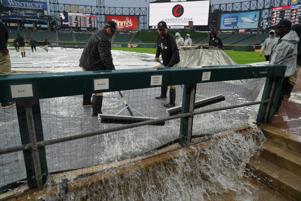
Hong Kong authorities have deployed powerful machines known as “water-pumping dragons” to clear flooding after the city’s northern territories were hit by heavy rainfall overnight.
The Drainage Services Department deploys a powerful machine known as the “water-pumping dragon” to clear flooding on May 20, 2026. Photo: Drainage Services Department, via Facebook.
The Drainage Services Department said on social media early on Thursday that its teams had cleared seven instances of flooding in
Hong Kong authorities have deployed powerful machines known as “water-pumping dragons” to clear flooding after the city’s northern territories were hit by heavy rainfall overnight.
The Drainage Services Department deploys a powerful machine known as the “water-pumping dragon” to clear flooding on May 20, 2026. Photo: Drainage Services Department, via Facebook.
The Drainage Services Department said on social media early on Thursday that its teams had cleared seven instances of flooding in the northern part of the New Territories using the devices, which authorities procured from mainland China last year due to more frequent extreme downpours.
The Observatory issued the red rainstorm warning at 2.40am due to heavy rain in the city’s border areas near Shenzhen, especially in Sheung Shui, Ta Kwu Ling, and Sha Tau Kok. A special landslide warning was also issued.
The rainstorm signal was downgraded to amber at 5.15am and eventually cancelled at 9.30am. The weather services warned of the risk of river flooding.
The heavy rain was associated with “upper-air disturbances… persistently affecting the vicinity of the Pearl River Estuary,” the Observatory said on Thursday.
“Locally, more than 50 millimetres of rainfall were recorded over widespread areas this morning, and rainfall even exceeded 100 millimetres over many parts of the New Territories,” it added.
The flooding was concentrated in Sheung Shui and Fanling, while the Shek Kong Airfield Road was also affected, according to the Drainage Services Department.
An emergency control centre was activated at 9.45pm on Wednesday, and 90 response teams were deployed to inspect and clear flooding, the department said.
Images and videos of severe flooding went viral on social media platforms. Clips posted on Threads show floodwater entering a bus in Ping Che and a taxi trapped on the road.
Screenshot of a video shows floodwater entering a bus in Ping Che in Hong Kong in the early hours of May 20, 2026. Photo: t_tsuntsun, via Threads.
Screenshot of a video shows a taxi trapped in floodwater in Ping Che, Hong Kong, in the early hours of May 20, 2026. Photo: t_tsuntsun, via Threads.
Last year, after the city hoisted the black rainstorm warning four times within a week, a former Observatory official warned that extreme weather would become more frequent due to the climate crisis.
In its annual forecast of the upcoming Atlantic Hurricane season, NOAA suggests the 2026 season has a 55% chance of being below normal, compared with a 35% chance of being near normal and just a 10% chance of being above normal.
The forecast, announced at a press conference at the NOAA Aircraft Operations Center in Lakeland, Fla., includes 8 to 14 named storms (with winds of at least 39 miles per hour), 3 to 6 of which will be hurricanes (with winds of at least 74 miles per hour). One to thr
In its annual forecast of the upcoming Atlantic Hurricane season, NOAA suggests the 2026 season has a 55% chance of being below normal, compared with a 35% chance of being near normal and just a 10% chance of being above normal.
The forecast, announced at a press conference at the NOAA Aircraft Operations Center in Lakeland, Fla., includes 8 to 14 named storms (with winds of at least 39 miles per hour), 3 to 6 of which will be hurricanes (with winds of at least 74 miles per hour). One to three of those are forecast to be major hurricanes (category 3 to 5 storms, with winds of at least 111 miles per hour).
NOAA forecasts that a below-average hurricane season is most likely in 2026, largely because of El Niño conditions. Credit: NOAA
A below-average number of hurricanes does not reduce the need for people to be prepared, NOAA representatives emphasized.
“Even though we’re expecting a below-average season in the Atlantic, it’s very important to understand that it only takes one.”
“Even though we’re expecting a below-average season in the Atlantic, it’s very important to understand that it only takes one,” said Under Secretary of Commerce for Oceans and Atmosphere and NOAA Administrator Neil Jacobs. “We have had category 5s make landfall in the past during below-average seasons.”
In contrast, NOAA is forecasting an above-average season in the Pacific, with a 70% likelihood of above-normal activity.
Matthew Rosencrans, lead hurricane forecaster with NOAA’s National Weather Service, noted that the Atlantic forecast does not yet contain information about potential hurricane landfalls, just the likelihood of their formation. National Weather Service Director Ken Graham said the potential for rapid intensification—when wind speed increases by at least 35 miles per hour over the course of 24 hours—makes early preparedness particularly important.
“Every category 5 that’s made landfall in this country was a tropical storm or less 3 days out,” he said. “So they rapidly intensified that quick. You think you might have a week on your timeline. The reality is you may only have days.”
“There will never be a ‘Hurricane Justa,’” he added. “There’s no such thing as just a category 1, just a tropical storm, just a category 2.…Even the smallest storm, if it’s slow enough and big enough, it’s going to be catastrophic flooding and storm surge.”
The Atlantic hurricane season runs from 1 June to 30 November. The NOAA forecast is in line with an Atlantic hurricane forecast issued 9 April by Colorado State University (CSU), which predicted 13 named storms and 6 hurricanes, including 2 major hurricanes. Similarly, a forecast released 22 April by North Carolina State University predicted 12 to 15 named storms, 6 to 9 hurricanes, and 2 to 3 major hurricanes.
All three forecasts are slightly below the average Atlantic hurricane numbers for 1991–2020: 14.4 named storms, 7.2 hurricanes, and 3.2 major hurricanes.
The World Meteorological Organization has released its list of 2026 Atlantic tropical cyclone names. Credit: NOAA
El Niño
The forecast for below-average activity levels largely stems from El Niño, a climate pattern that increases vertical wind shear over the tropical Atlantic. Vertical wind shear is how much the speed and direction of wind change with altitude. When wind shear is too high, it can tear a hurricane apart before it forms.
“Wind shear is good for us, bad for the hurricanes,” said Phil Klotzbach, a hurricane forecaster at Colorado State University and lead author of the CSU report.
This year, researchers suggest El Niño could become the strongest in modern history, which could have ripple effects on global temperatures. At the NOAA press conference, Jacobs said that there is a 98% chance of El Niño conditions occurring later this season and an 80% chance that it will be moderate to strong. The forecasted strength of El Niño has only grown since CSU issued its forecast, Klotzbach said.
However, in addition to high wind shear, El Niño is also characterized by unusually warm waters in the Pacific. Klotzbach compared the warm waters of El Niño to loaded dice.
“If the waters are a little bit warmer, that will load the dice for the storm to get stronger.”
“To get to a hurricane, you need to have warm water,” he said. “You need to have a lot of other stuff as well, but if the waters are a little bit warmer, that will load the dice for the storm to get stronger.”
El Niño isn’t the only reason our oceans are warming.
At a press briefing hosted by Covering Climate Now prior to the NOAA press conference, Shel Winkley, a meteorologist at Climate Central, noted that about 90% of the excess heat caused by greenhouse gas emissions has gone into Earth’s oceans, as the planet tries to keep our atmosphere in balance.
“We’re not saying that climate change necessarily creates hurricanes,” Winkley said. “But it is supercharging them: More intense winds, heavier rain, bigger flooding. That’s the connection that we can confidently draw.”
Citation: Gardner, E. (2026), NOAA forecasts a below-average hurricane season, Eos, 107, https://doi.org/10.1029/2026EO260171. Published on 21 May 2026.
Critically endangered Tapanuli orangutan population falls after heavy rain and landslides, fuelled by climate crisis, in North SumatraExtreme rainfall and landslides fuelled by the climate crisis killed 7% of the remaining population of the world’s rarest great ape, a study has found, prompting fears for the species’ survival.The research suggests 58 out of the remaining 800 critically endangered Tapanuli orangutans (Pongo tapanuliensis) were killed after more than 1,000mm (39in) of rain fell ov
Critically endangered Tapanuli orangutan population falls after heavy rain and landslides, fuelled by climate crisis, in North Sumatra
Extreme rainfall and landslides fuelled by the climate crisis killed 7% of the remaining population of the world’s rarest great ape, a study has found, prompting fears for the species’ survival.
The research suggests 58 out of the remaining 800 critically endangered Tapanuli orangutans (Pongo tapanuliensis) were killed after more than 1,000mm (39in) of rain fell over four days in Indonesia’s North Sumatra province in November 2025. This equates to 11% of the local population and 7% of the entire species.