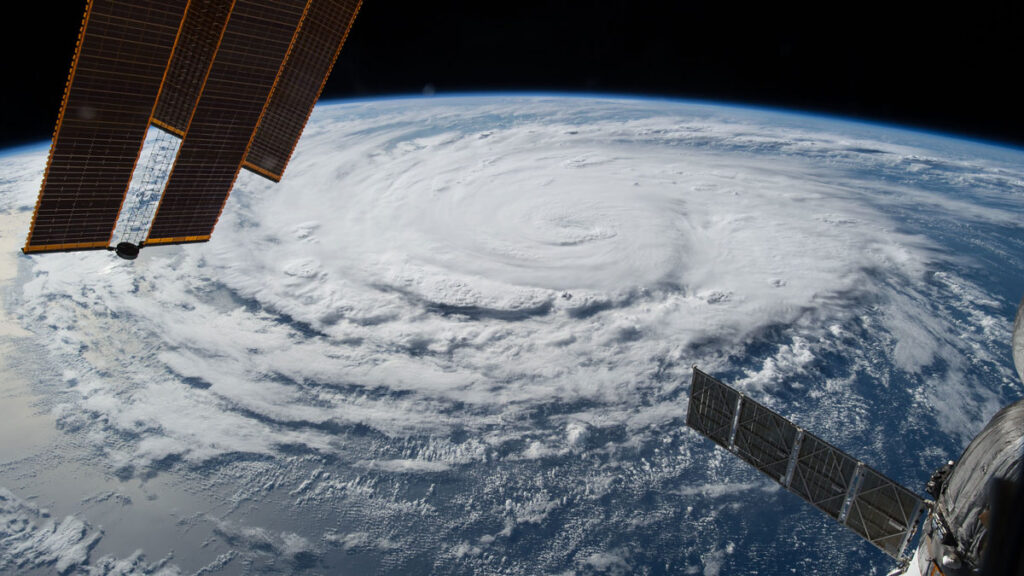
NOAA Forecasts a Below-Average Hurricane Season
In its annual forecast of the upcoming Atlantic Hurricane season, NOAA suggests the 2026 season has a 55% chance of being below normal, compared with a 35% chance of being near normal and just a 10% chance of being above normal.
The forecast, announced at a press conference at the NOAA Aircraft Operations Center in Lakeland, Fla., includes 8 to 14 named storms (with winds of at least 39 miles per hour), 3 to 6 of which will be hurricanes (with winds of at least 74 miles per hour). One to three of those are forecast to be major hurricanes (category 3 to 5 storms, with winds of at least 111 miles per hour).
A below-average number of hurricanes does not reduce the need for people to be prepared, NOAA representatives emphasized.
“Even though we’re expecting a below-average season in the Atlantic, it’s very important to understand that it only takes one.”
“Even though we’re expecting a below-average season in the Atlantic, it’s very important to understand that it only takes one,” said Under Secretary of Commerce for Oceans and Atmosphere and NOAA Administrator Neil Jacobs. “We have had category 5s make landfall in the past during below-average seasons.”
In contrast, NOAA is forecasting an above-average season in the Pacific, with a 70% likelihood of above-normal activity.
Matthew Rosencrans, lead hurricane forecaster with NOAA’s National Weather Service, noted that the Atlantic forecast does not yet contain information about potential hurricane landfalls, just the likelihood of their formation. National Weather Service Director Ken Graham said the potential for rapid intensification—when wind speed increases by at least 35 miles per hour over the course of 24 hours—makes early preparedness particularly important.
“Every category 5 that’s made landfall in this country was a tropical storm or less 3 days out,” he said. “So they rapidly intensified that quick. You think you might have a week on your timeline. The reality is you may only have days.”
“There will never be a ‘Hurricane Justa,’” he added. “There’s no such thing as just a category 1, just a tropical storm, just a category 2.…Even the smallest storm, if it’s slow enough and big enough, it’s going to be catastrophic flooding and storm surge.”
The Atlantic hurricane season runs from 1 June to 30 November. The NOAA forecast is in line with an Atlantic hurricane forecast issued 9 April by Colorado State University (CSU), which predicted 13 named storms and 6 hurricanes, including 2 major hurricanes. Similarly, a forecast released 22 April by North Carolina State University predicted 12 to 15 named storms, 6 to 9 hurricanes, and 2 to 3 major hurricanes.
All three forecasts are slightly below the average Atlantic hurricane numbers for 1991–2020: 14.4 named storms, 7.2 hurricanes, and 3.2 major hurricanes.
El Niño
The forecast for below-average activity levels largely stems from El Niño, a climate pattern that increases vertical wind shear over the tropical Atlantic. Vertical wind shear is how much the speed and direction of wind change with altitude. When wind shear is too high, it can tear a hurricane apart before it forms.
“Wind shear is good for us, bad for the hurricanes,” said Phil Klotzbach, a hurricane forecaster at Colorado State University and lead author of the CSU report.
This year, researchers suggest El Niño could become the strongest in modern history, which could have ripple effects on global temperatures. At the NOAA press conference, Jacobs said that there is a 98% chance of El Niño conditions occurring later this season and an 80% chance that it will be moderate to strong. The forecasted strength of El Niño has only grown since CSU issued its forecast, Klotzbach said.
However, in addition to high wind shear, El Niño is also characterized by unusually warm waters in the Pacific. Klotzbach compared the warm waters of El Niño to loaded dice.
“If the waters are a little bit warmer, that will load the dice for the storm to get stronger.”
“To get to a hurricane, you need to have warm water,” he said. “You need to have a lot of other stuff as well, but if the waters are a little bit warmer, that will load the dice for the storm to get stronger.”
El Niño isn’t the only reason our oceans are warming.
At a press briefing hosted by Covering Climate Now prior to the NOAA press conference, Shel Winkley, a meteorologist at Climate Central, noted that about 90% of the excess heat caused by greenhouse gas emissions has gone into Earth’s oceans, as the planet tries to keep our atmosphere in balance.
“We’re not saying that climate change necessarily creates hurricanes,” Winkley said. “But it is supercharging them: More intense winds, heavier rain, bigger flooding. That’s the connection that we can confidently draw.”
—Emily Gardner (@emfurd.bsky.social), Associate Editor