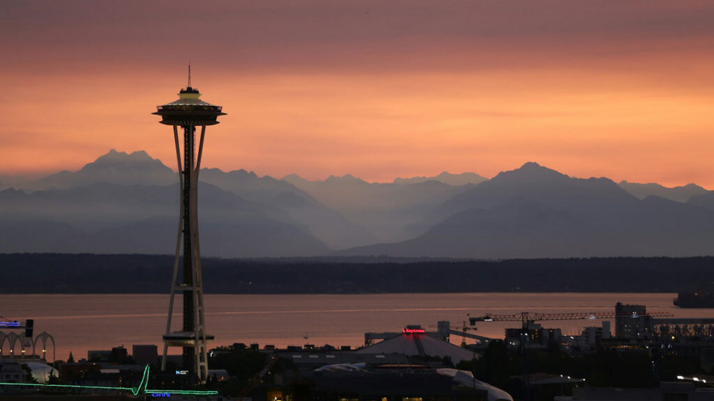
On the Seattle Fault, the Biggest Quakes Aren’t the Most Likely
In the winter of 923, a magnitude 7.5 earthquake struck the heart of Puget Sound. Shorelines slid into the water, the seafloor rose up, and a tsunami swept through the region.
The Seattle fault zone, actually a mesh of faults that runs right under its eponymous city, was responsible for this quake. The fault continues to pose one of the deadliest threats to the Pacific Northwest; if a similar quake were to hit today, it would threaten millions of lives and cause billions of dollars in damage.
Two new papers dig into recurrence intervals, or the quiescent periods between earthquakes, for the Seattle fault zone. They offer good news and bad news: One study, published in Geology, found that in the past 11,000 years, the massive 923 event was the only quake of magnitude 7.5 or greater. The other study, published in GSA Bulletin, found that smaller, but still damaging, quakes occur more frequently than previously thought.
The new research indicates the worst-case scenario of frequent 923-style events is less likely than some scientists thought, said Harold Tobin, a geophysicist at the University of Washington and head of the Pacific Northwest Seismic Network, who was not involved in either study. But researchers also found that “the less worse, but still bad scenarios” are more likely than previously thought.
Meet the Seattle Fault
“For a fault that has had so much attention, there’s so much we still don’t know.”
The Seattle fault zone is a thrust fault system that stretches about 75 kilometers (46 miles) from the foothills of the Cascades east of Seattle to the Hood Canal, which runs along the shores of the Olympic Peninsula to the city’s west, passing under Seattle along the way.
Geologists began rigorously exploring the fault system in the early 1990s, intrigued by gravitational anomalies, uplifted marine terraces (stair-step geological formations along coastlines), and evidence of a roughly 1,000-year-old tsunami. All these features hinted at a major, shallow earthquake on a local fault zone—likely the 923 event.
But “for a fault that has had so much attention, there’s so much we still don’t know,” said Elizabeth Davis, an earthquake geologist at the University of Washington who led the Geology study.
The most pressing questions are how big quakes on the fault get, how often they hit, and, ultimately, what risks the fault poses to people who live in the Puget Sound area.
“It takes some real geologic sleuthing to get at those tough questions,” Tobin said.
Biggest Seattle Fault Quakes Are Rare
Davis focused on the activity of the main fault, which can generate the biggest quakes in the Seattle fault zone complex. It was responsible for the 923 quake. But the existing record went back only about 5,000 years.
“We just don’t know what the recurrence interval for these big quakes is,” Davis said. “We wanted to lengthen the record.”
To do so, Davis and her collaborators turned to marine terraces, the oldest of which date back to the end of the last ice age about 11,000 years ago. The quake in 923 raised terraces by about 8 meters (26 feet), and scientists wanted to look for similar-scale uplift in terraces all around the sound.
The researchers mapped more than 150 terraces around Puget Sound and measured their depths. After accounting for regional slopes, they estimated uplift over time that could have been caused by quakes.
They found that in that 11,000-year period, only the 923 event generated significant uplift. Thick sediment mantles could mask smaller events but not 923-scale quakes, Davis said.
Estimating true recurrence intervals requires knowing the timing of multiple events. But the finding is “not bad news,” she said. It provides some evidence that the recurrence interval is likely not shorter than about 5,000 years.
“That could give us more of a buffer between now and when the next big one like that will happen,” said Stephen Angster, a U.S. Geological Survey geologist who led the GSA Bulletin study.
Smaller, Damaging Quakes Are More Frequent
Angster’s work focused on Seattle’s secondary faults, which are smaller, mostly blind faults (those not visible at the surface) capable of generating damaging earthquakes. Previous work had shown that one of these secondary faults generated a magnitude 6.7 earthquake, highlighting the risk they pose. Angster wanted to explore rupture histories of these secondary faults, particularly whether they could rupture independently from the main fault.
The researchers used a suite of paleoseismic tools, including magnetic data, field and lidar mapping, trenches dug across faults, and geochronology. They studied two newly identified secondary faults that have orientations similar to the main fault.
They found three new earthquakes to add to the region’s seismic history, including the oldest and youngest events in the known record, which were around 11,000 years ago and in the early 1800s, respectively. The earthquakes appear to be evidence of ruptures that occurred independently of the main fault, suggesting that the smaller—but still dangerous—secondary faults should be considered in hazard modeling.
With that lengthened record and the addition of three quakes, the recurrence interval the researchers found was about every 350 years over the past 2,500 years. This timing refined the previous estimate of every several hundred years.
There also appears to be an increase in activity over the past 2,000 years.
“Maybe we should be paying attention to that,” Angster said.
What Happens Next
“There are other earthquakes that aren’t as big but that occur more frequently. Those might not be as catastrophic, but it would be a very bad scenario for Seattle” if such events occurred.
“These are both carefully done studies,” Tobin said. “We now have evidence that the 923 event was the biggest in 11,000 years. But there are other earthquakes that aren’t as big but that occur more frequently. Those might not be as catastrophic, but it would be a very bad scenario for Seattle” if such events occurred.
It’s still to be determined whether the risk from secondary faults will be incorporated into the National Seismic Hazard Model, which includes the 923 quake but not smaller ones along the Seattle fault zone. The secondary faults were left out in previous efforts because they are shorter than the minimum length required to be included and because of uncertainties in their potential rupture magnitude.
—Rebecca Dzombak (@rdzombak.bsky.social), Science Writer