In video, The Hills actor, who did not contest the outcome of the election, said his campaign to ‘save’ LA was just startingSpencer Pratt appeared to concede the Los Angeles mayor’s race on Friday in a new video where he says “the campaign portion of my mission to save Los Angeles is coming to a close”, but declares “war” against the two candidates advancing to the city’s general election.In the video posted on social media, Pratt notably did not contest the results of the election, despite Dona
In video, The Hills actor, who did not contest the outcome of the election, said his campaign to ‘save’ LA was just starting
Spencer Pratt appeared to concede the Los Angeles mayor’s race on Friday in a new video where he says “the campaign portion of my mission to save Los Angeles is coming to a close”, but declares “war” against the two candidates advancing to the city’s general election.
In the video posted on social media, Pratt notably did not contest the results of the election, despite Donald Trump’s repeated, but unfounded claims the race was “rigged”. Trump, who endorsed Pratt, called California’s elections “crooked”.
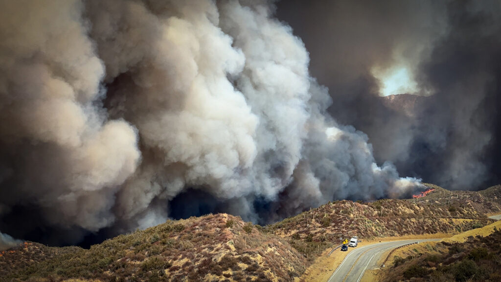
Defense says no evidence occasional Uber driver Jonathan Rinderknecht ignited deadly blaze on New Year’s Day 2025The trial of 29-year-old Jonathan Rinderknecht, the man accused of starting last year’s deadly Palisades fire, kicked off on Wednesday with opening arguments. Prosecutors cast him as a vengeful arsonist who sought to hide his role from authorities, while his defense attorneys argued that the fire was caused by fireworks.On New Year’s Day in 2025, firefighters extinguished a small blaz
Defense says no evidence occasional Uber driver Jonathan Rinderknecht ignited deadly blaze on New Year’s Day 2025
The trial of 29-year-old Jonathan Rinderknecht, the man accused of starting last year’s deadly Palisades fire, kicked off on Wednesday with opening arguments. Prosecutors cast him as a vengeful arsonist who sought to hide his role from authorities, while his defense attorneys argued that the fire was caused by fireworks.
On New Year’s Day in 2025, firefighters extinguished a small blaze in the Pacific Palisades, a coastal Los Angeles enclave. But the flames continued to smolder underground, before reigniting as they were picked up by strong winds. The Palisades fire, the most destructive wildfires in city history, tore through roughly 23,000 acres, incinerating thousands of buildings and killing 12 people.
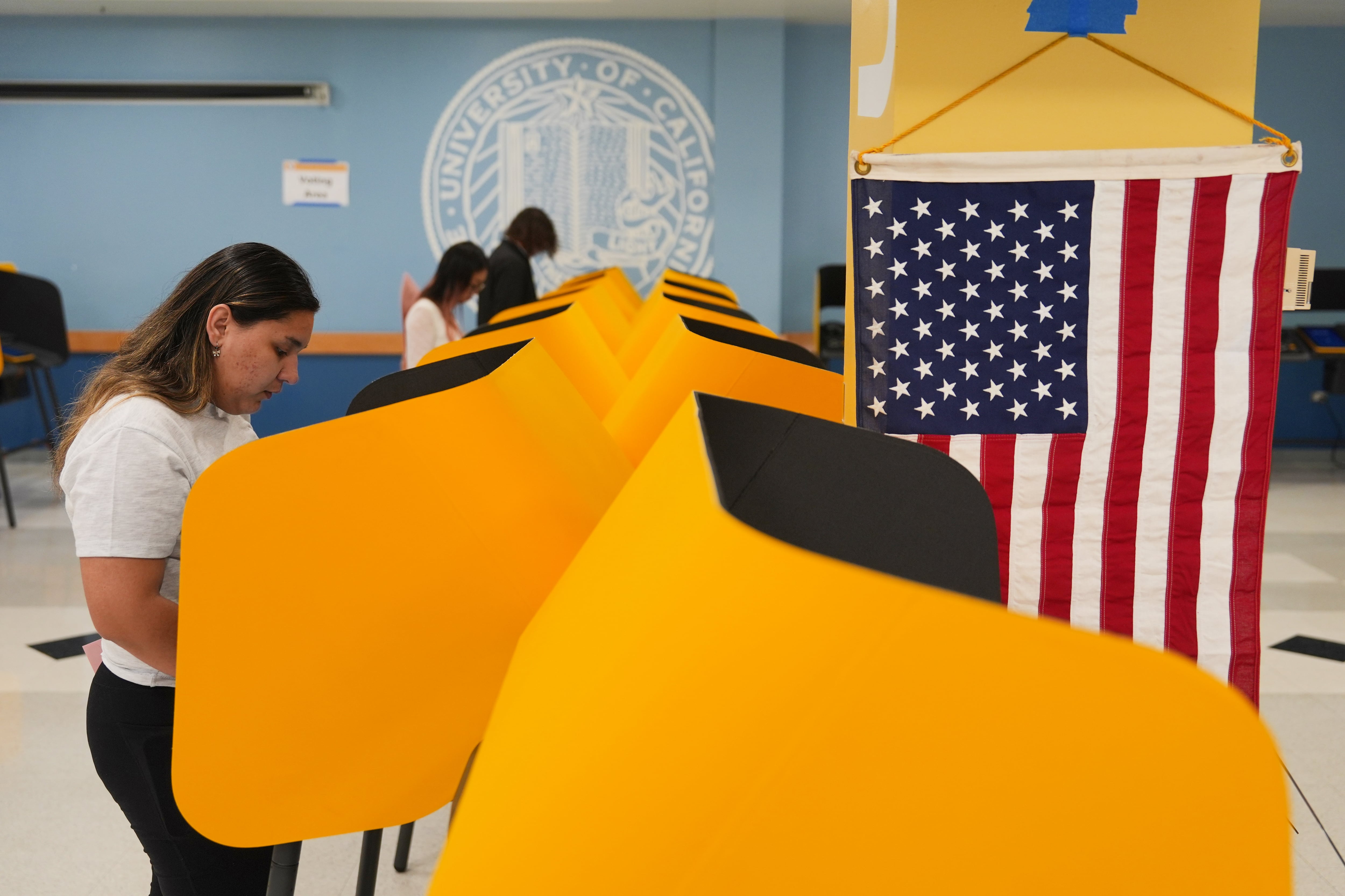
California Democrats’ bid to retake control of Congress through redistricting efforts to include more of their voters in heavily Republican areas is running into its first barrier in a race in a district east of Los Angeles. Preliminary counts put two Republican candidates in the top two spots, which would set up a contest between them for the seat in the November midterm elections. In other races that Democrats consider key, their candidates have advanced to a November runoff.Seguir leyendo
California Democrats’ bid to retake control of Congress through redistricting efforts to include more of their voters in heavily Republican areas is running into its first barrier in a race in a district east of Los Angeles. Preliminary counts put two Republican candidates in the top two spots, which would set up a contest between them for the seat in the November midterm elections. In other races that Democrats consider key, their candidates have advanced to a November runoff.
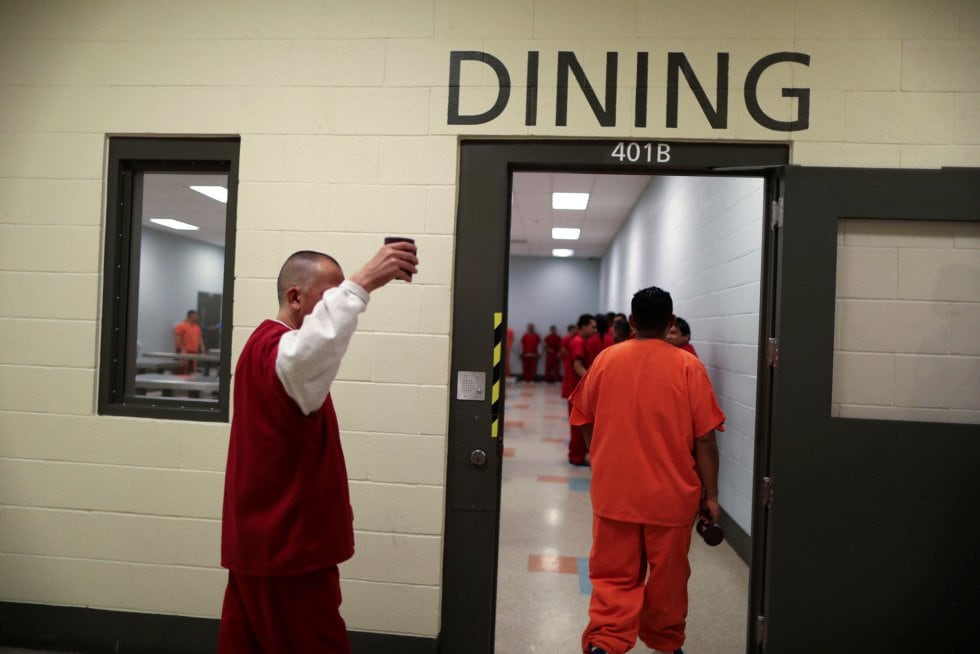
Esteban had never heard of the prison gang Los Paisas until he was held at the Adelanto immigrant detention center in California. As soon as he passed through the bars of his housing unit, other detainees made it clear he had to choose: join them or join another group made up of Russians, Indians, Chinese, and Armenians. He understood that doing neither would leave him defenseless, so he accepted. There was no initiation ritual and he was not asked to swear allegiance. The rules were simple: pro
Esteban had never heard of the prison gang Los Paisas until he was held at the Adelanto immigrant detention center in California. As soon as he passed through the bars of his housing unit, other detainees made it clear he had to choose: join them or join another group made up of Russians, Indians, Chinese, and Armenians. He understood that doing neither would leave him defenseless, so he accepted. There was no initiation ritual and he was not asked to swear allegiance. The rules were simple: protect your own from violent people, settle internal disputes, and keep a measure of order in a place where authority often seemed insufficient. Over the months, deportations and transfers took away people he knew. They were replaced by newcomers, some of whom did not understand the dynamics of detention. He had to teach them. Before he knew it, Esteban was among the most long-standing members and, without seeking the role, he became one of the leaders of the gang.
Source: AGU Advances
Urbanization, climate change, and fire suppression practices are contributing to increased wildfire risk at the densely populated wildland-urban interface. These factors make fires more unpredictable and harder to manage. In January 2025, this was made devastatingly clear in Los Angeles, when massive wildfires engulfed entire hillsides and canyons, destroying neighborhoods and damaging surrounding ecosystems.
The Mediterranean climate region of California, which stret
Urbanization, climate change, and fire suppression practices are contributing to increased wildfire risk at the densely populated wildland-urban interface. These factors make fires more unpredictable and harder to manage. In January 2025, this was made devastatingly clear in Los Angeles, when massive wildfires engulfed entire hillsides and canyons, destroying neighborhoods and damaging surrounding ecosystems.
The Mediterranean climate region of California, which stretches up most of the state’s coastline, is a naturally fire-prone landscape because its dry conditions support vegetation growth and also allow for fire to spread easily. As wildfires become more intense, better modeling and understanding of their drivers is crucial in efforts to predict risk.
Ward-Baranyay et al. looked at three of the January 2025 Los Angeles wildfires by analyzing preburn conditions, such as fuel characteristics, topography (including elevation and slope), and wind speed. Satellite observations gathered from the Ecosystem Spaceborne Thermal Radiometer Experiment on Space Station (ECOSTRESS) and the Earth Surface Mineral Dust Source Investigation (EMIT)—precursors to a recently announced NASA mission, the Explorer for Artemis Geology Lunar and Earth (EAGLE)—provided detailed information about the vegetation’s condition before the fires began. The researchers then built a random forest regression model to predict burn severity based on these conditions, ultimately demonstrating that prefire fuel conditions were a key driver of the destructive wildfires’ immediate effects on wildlands.
The model used in the study was able to accurately capture about 60% of the patterns in burn severity. It was most accurate for the Palisades and Hughes fires, but less accurate for the Eaton Fire. This discrepancy could be because the area burned by the Eaton Fire was more topographically variable, meaning its burn severity drivers may not have been fully captured by the model, the researchers suggest. Vegetation type was also a strong performance indicator: Terrain with shrub or scrub cover, the dominant vegetation type, offered the most accurate predictions for burn severity. The burn patterns of forests and other landscape types were less accurately captured.
Fuel conditions emerged as the dominant driver of burn severity, more so than topography or weather. In particular, how abundant, wet, dry, or stressed vegetation is can hint at how severe future fires may be. Tracking and monitoring these fuel conditions, researchers suggest, may be a way to monitor wildfire hazard in California and other fire-prone regions. (AGU Advances, https://doi.org/10.1029/2025AV002179, 2026)
Citation: Owen, R. (2026), Want to predict wildfire severity? Look to the state of vegetation, Eos, 107, https://doi.org/10.1029/2026EO260130. Published on 4 May 2026.
U.S. Immigration and Customs Enforcement (ICE) detained Enrique Martínez Chávez on Wednesday in Los Angeles, California, according to a statement the agency released Thursday on social media. The 32‑year‑old detainee is one of the military officers linked to the disappearance of 43 student teachers in the Mexican municipality of Iguala, Guerrero, in 2014. Martínez Chávez is wanted in Mexico for the alleged crime of enforced disappearance and has been a fugitive from justice for years. ICE says h
U.S. Immigration and Customs Enforcement (ICE) detained Enrique Martínez Chávez on Wednesday in Los Angeles, California, according to a statement the agency released Thursday on social media. The 32‑year‑old detainee is one of the military officers linked to the disappearance of 43 student teachers in the Mexican municipality of Iguala, Guerrero, in 2014. Martínez Chávez is wanted in Mexico for the alleged crime of enforced disappearance and has been a fugitive from justice for years. ICE says he will remain in its custody “until he can be sent home” to Mexico.
Mother and brother were rescued after wave engulfed trio in Laguna Beach, as mayor calls news ‘heartbreaking’California officials have recovered the body of a five-year-old girl who earlier this week was swept into the ocean by turbulent waters.On Tuesday evening, the girl, her mother and brother were walking along the shore of Treasure Island Beach in Orange county, when a wave reportedly engulfed them. Continue reading...
Mother and brother were rescued after wave engulfed trio in Laguna Beach, as mayor calls news ‘heartbreaking’
California officials have recovered the body of a five-year-old girl who earlier this week was swept into the ocean by turbulent waters.
On Tuesday evening, the girl, her mother and brother were walking along the shore of Treasure Island Beach in Orange county, when a wave reportedly engulfed them.
Rep. Kevin Kiley (I-Calif.), a former Republican, is set for a showdown in November against a Democratic challenger, Decision Desk HQ has projected. Shortly before 8 p.m. EDT, Kiley had garnered 24.53 percent of the vote, while Democrat Richard Pan, a doctor and small business owner, had garnered 23.21 percent, per DDHQ. Pan and Kiley...
Rep. Kevin Kiley (I-Calif.), a former Republican, is set for a showdown in November against a Democratic challenger, Decision Desk HQ has projected. Shortly before 8 p.m. EDT, Kiley had garnered 24.53 percent of the vote, while Democrat Richard Pan, a doctor and small business owner, had garnered 23.21 percent, per DDHQ. Pan and Kiley...
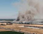
Fire at medical supplier Medline in Tracy, city of more than 100,000 residents, is affecting the air qualityCalifornia firefighters continued to battle a blaze on Saturday that had engulfed a roughly 1m sq ft warehouse, causing officials to warn residents over unhealthy air quality.The fire has been raging at the medical supplier Medline Industries’ warehouse in Tracy, a city of more than 100,000 residents located about 55 miles (90km) east of San Francisco. Officials expect to be battling the f
Fire at medical supplier Medline in Tracy, city of more than 100,000 residents, is affecting the air quality
California firefighters continued to battle a blaze on Saturday that had engulfed a roughly 1m sq ft warehouse, causing officials to warn residents over unhealthy air quality.
The fire has been raging at the medical supplier Medline Industries’ warehouse in Tracy, a city of more than 100,000 residents located about 55 miles (90km) east of San Francisco. Officials expect to be battling the fire for a few more days.
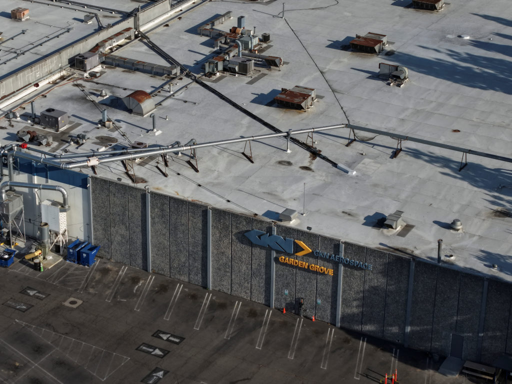
More than 100 individuals — including some families with pets — as well as local businesses are suing GKN Aerospace, saying the U.K.-based company was negligent in maintaining a safe facility, especially since it's located in a large population center.
More than 100 individuals — including some families with pets — as well as local businesses are suing GKN Aerospace, saying the U.K.-based company was negligent in maintaining a safe facility, especially since it's located in a large population center.