Reading view

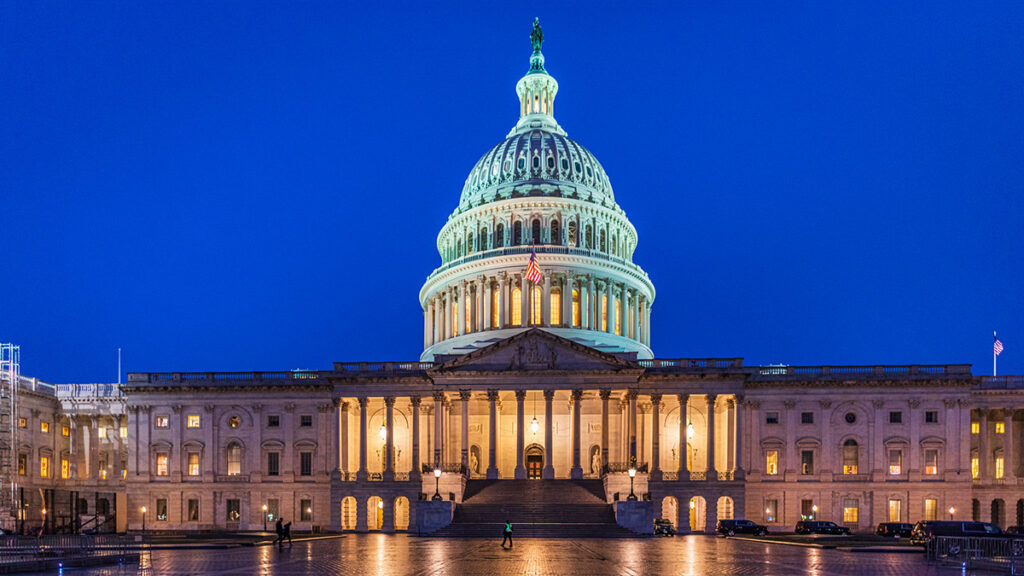
The 50-Hour Livestream That Aims to #SaveAmericasForecasts

Illustration of a blue television with the words “The Weather & Climate Livestream” on the screen.

Research & Developments is a blog for brief updates that provide context for the flurry of news that impacts science and scientists today.

This week, a parade of scientists will spend 50 hours straight speaking about the importance of weather and climate research in the United States.

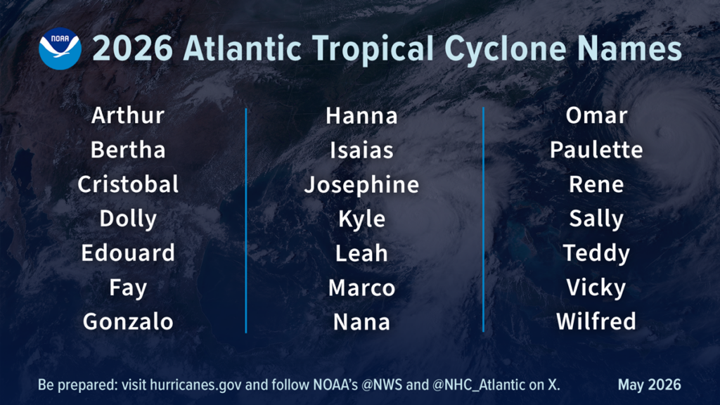
Now in its second year, the Weather & Climate Livestream will feature hundreds of scientists describing their work and why it matters. Last year’s event, which lasted 100 hours, saw more than 180,000 views and led to 30,000 phone calls to Congress to #SaveAmericasForecasts.

“The first aspect of it is just communicating science,” said Haley Crim, a climate literacy researcher at MIT and the founder of Climateliteracy.earth. “The second half of it is to inspire people to call their representatives in support of funding for climate and weather science, and science more broadly.”  

Last year, Crim was an “avid watcher” of the livestream, so she was happy to help when a friend asked her to pitch in for the second iteration. But it’s also more personal this year, as she has since lost her position as a contractor with NOAA.

“It has a whole new meaning now, this year,” she said.

The livestream begins at 4 p.m. ET on Monday, 1 June, ending at 6 p.m. ET on Wednesday, 3 June. Speakers include meteorologist Jeff Masters and climate scientists Adam Sobel of Columbia University and Kim Cobb of Brown University. AGU President Brandon Jones and president-elect Benjamin Zaitchik will also speak from 2 p.m. to 2:40 p.m. ET on Wednesday, 3 June.

Science Under Attack

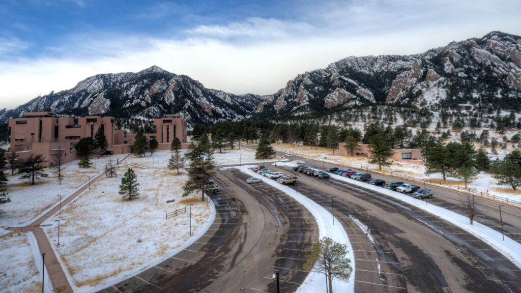
Since Donald Trump began his second presidential term in 2025, federal science funding has faced extensive cuts, with more proposed. In June 2025, for instance, a budget document proposed eliminating NOAA’s Office of Oceanic and Atmospheric Research. In December 2025, the administration announced plans to break up the National Center for Atmospheric Research.

“This is really a full-frontal attack on climate science.”

“This is really a full-frontal attack on climate science,” said Andrew Williams, a climate scientist at Scripps Institution of Oceanography who is helping to organize the livestream and will speak during it.

He added that even though Congress pushed back against the most drastic cuts proposed last year, leaving key science program budgets mostly intact, many agencies haven’t yet seen the money they’ve been granted in the budget. For instance, according to the organization Grant Witness, 112 grants have been awarded in the NSF Directorate for Geosciences so far this year, compared with 948 in total in Fiscal Year (FY) 2025. The average total number of grants awarded between FY21 and FY24 was 1,418.

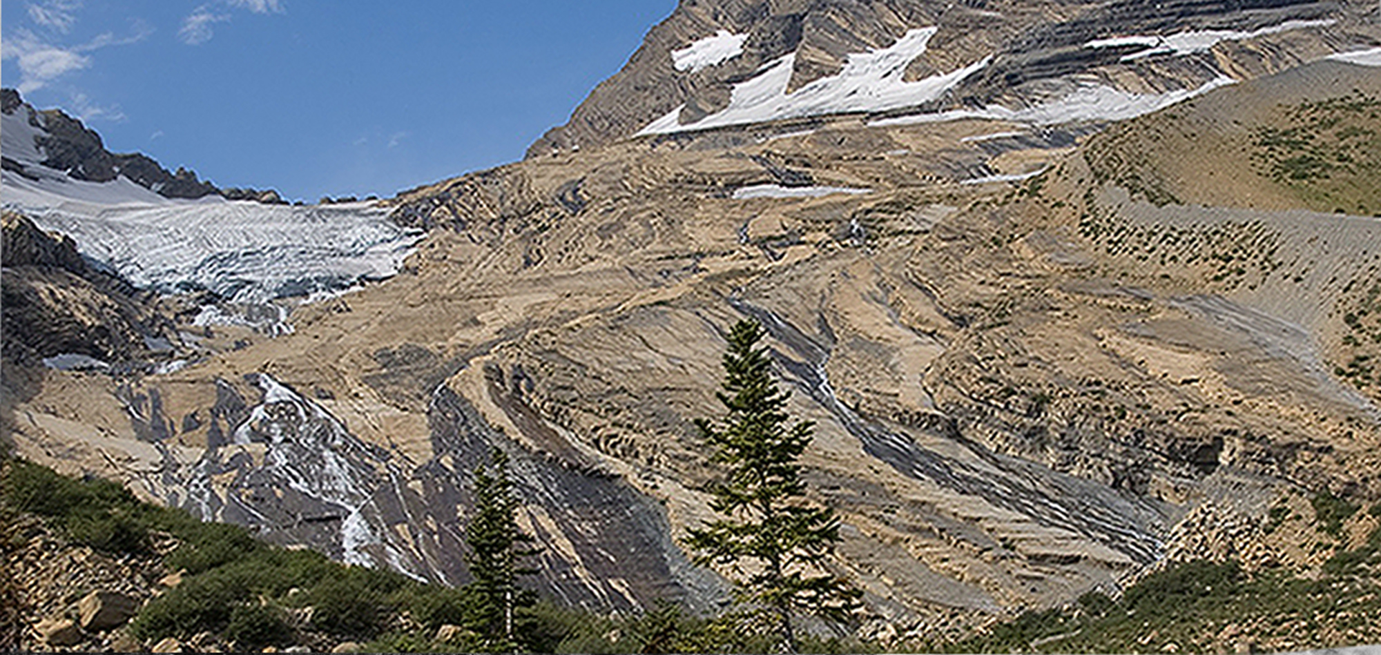
Both Crim and Williams said they hope the livestream provides the public with a better understanding of how climate and weather research affects us all, from allowing for timely evacuation warnings to affecting insurance rates. Williams offered the example of the Geophysical Fluid Dynamics Laboratory, a federally funded NOAA research lab that would be eliminated under the president’s proposed FY2027 budget.

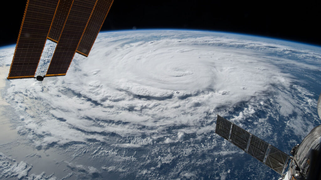
“It builds the engine of the U.S. weather forecasting model, which is what tells you day to day what the weather is going to be,” he said. “We’ve all been able to take for granted that these things are happening because the U.S. has for decades, for 60 or 70 years, had strong and stable federal funding for weather and climate science.”

—Emily Gardner (@emfurd.bsky.social), Associate Editor

These updates are made possible through information from the scientific community. Do you have a story about science or scientists? Send us a tip at eos@agu.org.

A photo of a hand holding a copy of an issue of Eos appears in a circle over a field of blue along with the Eos logo and the following text: Support Eos’s mission to broadly share science news and research. Below the text is a darker blue button that reads “donate today.”
Text © 2026. AGU. CC BY-NC-ND 3.0
Except where otherwise noted, images are subject to copyright. Any reuse without express permission from the copyright owner is prohibited.
  •  

Hundreds of Candidates Put the “Science” in “Political Science”

The U.S. capitol building seen at night.

Research & Developments is a blog for brief updates that provide context for the flurry of news regarding law and policy changes that impact science and scientists today.

More U.S. scientists are running for state and federal office in the U.S. midterm elections than ever before, Nature reports. Scientist-candidates represent an array of parties, although most profiled in Nature identify as Democrats.

314 Action, an organization focused on getting Democrats with scientific backgrounds elected to public office, offers financial support and training to candidates who apply for it. This year, the organization told Nature, they’ve received nearly three times as many applications as usual.

Sam Wang, a neuroscientist at Princeton and director of the Princeton Gerrymandering Project, is running to represent New Jersey’s 12th Congressional District.

“Usually, scientists stick with a specialized field,” Wang, a Democrat, wrote in an opinion for The Daily Princetonian. “However, I am deeply unhappy with how unequally power is divided in our society. So I have used my statistical abilities to level one part of democracy’s playing field: by repairing unfair elections.”

Why Now?

This year, Democratic candidates appear to be motivated by cuts to federal science programs, grants, and agencies, Nature reports, while Republican candidates like Jeff Wilson, who is running to represent the 13th district of Illinois, cite the pursuit of energy independence.  Third-party scientist-candidates have also run, and scientists are entering local and municipal arenas, too.

Specifically, with the recent repeal of the Endangerment Finding, loosened restrictions on pollution, and plans to break up the National Center for Atmospheric Research, some candidates and their supporters think science needs a more prominent position in public policy.

The rise in scientist candidates may also be part of an ongoing trend. More than 200 STEM professionals ran for office in the 2024 election, as Eos reported in October 2024.

“There are a lot of people who believe that science can help us live better lives and that science really does need to be front and center when we’re making public policy,” Jess Phoenix, a volcanologist, science advocate, and former Democratic candidate for the U.S. House of Representatives told Eos at the time.

In March, thousands of people attended Stand Up for Science rallies across the country to protest the misuse of science in federal policy and extensive staffing and funding cuts to scientific agencies. Since President Trump took office in 2025, more than 10,000 PhD-level scientists have left the federal workforce, Science reported in January.

Pew research data shows that public trust in scientists has declined since the COVID-19 pandemic, but it has seen modest improvements since 2023. The latest poll, released in January, found that 77% of adults in the United States have a great deal or a fair amount of confidence in scientists to act in the public’s best interest, compared to 73% in 2023. The percentage is consistently higher among Democrats than Republicans: 90% versus 65%, in 2026. In contrast, only 27% of respondents reported at least a fair amount of confidence in elected officials.

“The last thing I want [is] to become a politician,” wrote one Redditor in response to the Nature story. “But at this rate I may not have a choice if current politicians keep screwing it up.”

—Emily Gardner (@emfurd.bsky.social), Associate Editor

These updates are made possible through information from the scientific community. Do you have a story about how changes in law or policy are affecting scientists or research? Send us a tip at eos@agu.org.

A photo of a hand holding a copy of an issue of Eos appears in a circle over a field of blue along with the Eos logo and the following text: Support Eos’s mission to broadly share science news and research. Below the text is a darker blue button that reads “donate today.”
Text © 2026. AGU. CC BY-NC-ND 3.0
Except where otherwise noted, images are subject to copyright. Any reuse without express permission from the copyright owner is prohibited.
  •  

Tree Lines Are Migrating. Some Up, Some Down.

A clear tree line is visible on a mountain range.

As the climate warms, tree lines are generally understood to move up, because regions that were previously too cold for trees to survive now have higher, more tree friendly temperatures.

A tree line is clearly visible in the Swiss National Park, in Graubünden, Switzerland. Credit: Sabine Rumpf, University of Basel

This migration can be seen in these images of Canada’s Waterton Lakes National Park…

Rising tree lines are visible in Canada’s Waterton Lakes National Park, seen here in 1913 (left) and 2007 (right). Credit: Mountain Legacy Project

…and of Jackson Glacier in Montana’s Glacier National Park, for example.

A black-and-white image shows a glacier in a mountain pass.
Jackson Glacier, in Montana’s Glacier National Park, is seen here in 1912 and 2009. As the climate has warmed, the glacier has receded significantly, and tree lines have risen. Credit: MJ Elrod, U of M Library–9/3/2009, L McKeon, USGS

But new research, published in the International Journal of Applied Earth Observation and Geoinformation, paints a more complicated picture: Between 2000 and 2020, 42% of tree lines shifted up, true. But 25% of them actually moved downhill.

Sabine Rumpf, an ecologist at the University of Basel in Switzerland, said many studies of tree line shifts tend to be concentrated in limited geographic areas. A preponderance are based primarily on data from North America, Europe, and the Himalayas, where researchers are more likely to have funding to head to the field to take measurements themselves.

“But that also means that a large proportion of the surface of our planet is so understudied,” Rumpf said. “And [to remedy] that, remote sensing data [are] really amazing because you can get a truly global picture, even though there’s nobody, or too few people, observing things in the field.”

Tree Lines Aren’t Living up to Their Potential

So the team set out to take a more global look. They used a world mountain map, developed in 2018, with a 250-meter resolution. They did exclude some regions from their analysis: cells with less than 10% high-mountain coverage (which have so few trees that they don’t have much of a tree line) and cells more than 95% covered with trees (which have so many trees that they don’t have much of a tree line). For their purposes, the team defined the “observed tree line” as the upper limit of trees that stand 3 meters or taller.

Then, said Rumpf, they used a model to calculate the potential tree lines for each area, because, thanks to human effects on the environment, “where these trees could be surviving is almost always higher than where the trees are currently.” The model looked at the growing season length and mean growing season temperature for each cell in the map’s grid. The researchers determined that if a cell had a growing season length of 94 days or longer, and an average growing season temperature of 6.4°C or higher, it could potentially host trees. Cells that didn’t meet both criteria were considered unable to be covered in forest, and thus above the potential tree line.

With this model, “you can calculate based on climatic data where trees could potentially occur or not occur, even though they might not be there in the field,” Rumpf said. “It’s actually super simple. And that’s the beauty of it.”

Credit: Sabine Rumpf, University of Basel

Jordon Tourville, a terrestrial ecologist with the Appalachian Mountain Club, said the overall findings are not surprising, because other studies have shown seemingly “paradoxical downslope shifts in some cases.” But he noted that whereas this study estimated potential tree lines based on temperature constraints, some scientists have suggested that factors such as nutrient availability and wind exposure are also important in determining tree line position.

Unsurprising, on Second Thought

In areas with more human disturbance, the upward spread of trees is suppressed, or even reversed.

Armed with this information about observed versus potential tree lines, the researchers hypothesized that areas with the smallest deviation between the two were mostly responding to climatic factors. In contrast, they speculated, areas with a greater difference between observed and potential tree lines were likely experiencing more anthropogenic disturbance, such as logging, agriculture, and infrastructure development.

Their hypothesis held up. In areas with less human disturbance, tree lines were moving upward more quickly (the researchers noted, though, that the upward migration of tree lines lagged behind the rate of climate change). In areas with more human disturbance, the upward spread of trees is suppressed, or even reversed.

Fire played a big role in tree line shifts as well: The researchers found that 38% of the downslope shifts were linked to fire events. Wildfires played a particularly big role in western North America and Alaska.

Wildfires played a particularly large role in the downward shift of tree lines in western North America. Here, a tree line is visible in California’s Little Lakes Valley. Credit: mlhradio/Flickr, CC BY-NC 2.0
Blue circle with white text reading "Visit Teach the Earth for classroom activities to pair with this ENGAGE article." "Teach the Earth" is a logo with lines and triangles depicting mountains above the words and a shape denoting waves below them.

Rumpf and several of her colleagues are located in the Alps, where glaciers are retreating, tree lines are climbing, and towns are generally more threatened by mudslides than by wildfires.

Some of the study’s findings, like a quarter of tree lines shifting down, or such a clear signal from wildfires in some areas, were at first unexpected. But after some reflection, Rumpf realized the diversity of data was a perfect example of why global-scale research is important.

“A lot of scientific funding is based in North America and Europe,” Rumpf said, which means many studies return similar results. “Then we do something global and we are surprised that things are different somewhere else on the globe?… I mean, well, duh.”

—Emily Gardner (@emfurd.bsky.social), Associate Editor

This news article is included in our ENGAGE resource for educators seeking science news for their classroom lessons. Browse all ENGAGE articles, and share with your fellow educators how you integrated the article into an activity in the comments section below.

Citation: Gardner, E. (2026), Tree lines are migrating. Some up, some down., Eos, 107, https://doi.org/10.1029/2026EO260146. Published on 12 May 2026.
Text © 2026. The authors. CC BY-NC-ND 3.0
Except where otherwise noted, images are subject to copyright. Any reuse without express permission from the copyright owner is prohibited.
  •  

Judge Blocks NSF From Dismantling NCAR

The National Center for Atmospheric Research Building is seen on a snowy day, with the roads leading to it cleared, a few cars in the parking lot, and mountains just behind the building.

Research & Developments is a blog for brief updates that provide context for the flurry of news regarding law and policy changes that impact science and scientists today.

A Colorado judge has granted a preliminary injunction to the University Corporation for Atmospheric Research (UCAR). The move temporarily blocks the federal government from moving forward with one part of its effort to dismantle UCAR’s National Center for Atmospheric Research (NCAR) by transferring stewardship of a state-of-the-art supercomputing facility.

Together, UCAR—a nonprofit consortium of universities and colleges—and the National Science Foundation (NSF) operate and maintain the NCAR-Wyoming Supercomputing Center (NWSC) in Cheyenne, Wyo. The facility provides scientists with enormous computational power necessary to run sophisticated analyses of weather, climate, and other Earth systems.

In February, as another step in a chain of actions taken to dismantle NCAR, the NSF informed UCAR and NCAR that it would transfer management and operations of NWSC to a third-party operator.

In turn, UCAR filed a lawsuit alleging that the action violated federal law under the Administrative Procedure Act (APA). To halt NSF’s action under the act, the agency’s attempt to remove UCAR’s stewardship of the facility must be shown to be “arbitrary, capricious, an abuse of discretion, or otherwise not in accordance with law.”

Judge Richard Brooke Jackson of the U.S. District Court for the District of Colorado wrote in a 1 June court order that the action was both arbitrary and capricious “for at least two reasons.” First, NSF didn’t offer an explanation for its decision, and second, it didn’t follow an outlined process to consider public feedback.

The decision means that UCAR will temporarily retain its stewardship of NWSC. 

“NSF’s failure to provide any explanation for its decision—let alone a reasonable one—thwarts meaningful judicial review and renders the challenged action arbitrary and capricious,” Jackson wrote.

He went on to note that efforts to transfer stewardship of UCAR assets, including the supercomputing center, to other institutions, pose the risk of “irreparable harm” to UCAR. One of the chief harms would be brain drain, the judge noted multiple times, writing that “UCAR cannot easily replace employees with the level of education, specialized training, and institutional knowledge necessary to operate and maintain the NWSC’s ‘highly integrated, high-performance supercomputing system.'”

In addition to brain drain, Jackson cited financial injuries to UCAR that would be “difficult, if not impossible” to quantify, as well as an overall threat to the consortium’s mission.

“Any degradation in forecasting, modeling, or related scientific capabilities carries real-world consequences, including potential harm to property and human life. Given those stakes, the public interest strongly favors maintaining the status quo unless and until NSF demonstrates that its transfer decision complies with the APA,” he concluded.

In a statement posted to the UCAR website, the consortium’s interim president, Eric Barron, said UCAR was pleased that Judge Jackson recognized how harmful the proposed transfer would be for the the nation’s scientific enterprise.

“UCAR’s top priority is to advance Earth system science in service to society,” he wrote. “Today’s decision ensures that the NWSC will be able to continue its vital work on behalf of the United States and its stakeholders without interruption.”

—Grace van Deelen (@gvd.bsky.social), Staff Writer, and Emily Gardner, (@emfurd.bsky.social), Associate Editor

These updates are made possible through information from the scientific community. Do you have a story about how changes in law or policy are affecting scientists or research? Send us a tip at eos@agu.org.

A photo of a hand holding a copy of an issue of Eos appears in a circle over a field of blue along with the Eos logo and the following text: Support Eos’s mission to broadly share science news and research. Below the text is a darker blue button that reads “donate today.”
Text © 2026. AGU. CC BY-NC-ND 3.0
Except where otherwise noted, images are subject to copyright. Any reuse without express permission from the copyright owner is prohibited.
  •  

NSF Eliminates Geoscience Postdocs

A row of microscopes sit on a lab bench.

Research & Developments is a blog for brief updates that provide context for the flurry of news regarding law and policy changes that impact science and scientists today.

The National Science Foundation (NSF) has eliminated its postdoctoral fellowship funding for Earth scientists.

On the NSF website, the opportunity is listed as “archived.” This first came to the attention of Eos this week, although a Redditor had posted about the opportunity being archived as far back as March.

“What do you do when the most powerful people in the country just decide that your field shouldn’t exist anymore?” asked one Earth scientist on Bluesky.

“So, what are we doing now that we’re just not going to have new grants in GEO?” asked another.

According to the last program solicitation, posted in October 2024, the program generally awarded about $2.78 million each year, funding 8 to 10 postdoctoral fellowships. Proposals could be related to any of the disciplines within the scope of NSF’s Division of Earth Sciences (EAR), part of the NSF Directorate for Geosciences (NSF GEO).

The NSF announced an “organizational realignment” in December 2025. As part of the agencywide reorganization, GEO gained new leadership in February 2026. Joydip Kundu, the new NSF GEO Directorate Head, first joined NSF GEO in July 2025 as the agency’s deputy assistance director, coming from the NSF Directorate for Computer and Information Science and Engineering. He previously worked for the White House Office of Management and Budget (under President Obama) and the University of Maryland. Like Kundu, NSF’s new deputy directorate heads also came from within the agency.

When contacted about the archived opportunity, an NSF spokesperson confirmed to Eos that “The EAR postdoc fellowship solicitation has been archived and will not have a competition this fall. NSF regularly evaluates its portfolio of funding opportunities and will continue to explore funding opportunities for early career geoscientists.”

NSF continues to offer fellowship opportunities to postdoctoral researchers in the fields of engineering, entrepreneurial research, mathematics and physical sciences. Fellowships to postdocs in biology are available only if they involve the use of artificial intelligence.

—Emily Gardner (@emfurd.bsky.social), Associate Editor

These updates are made possible through information from the scientific community. Do you have a story about how changes in law or policy are affecting scientists or research? Send us a tip at eos@agu.org.

A photo of a hand holding a copy of an issue of Eos appears in a circle over a field of blue along with the Eos logo and the following text: Support Eos’s mission to broadly share science news and research. Below the text is a darker blue button that reads “donate today.”
Text © 2026. AGU. CC BY-NC-ND 3.0
Except where otherwise noted, images are subject to copyright. Any reuse without express permission from the copyright owner is prohibited.
  •  

NOAA Forecasts a Below-Average Hurricane Season

A hurricane on Earth is seen from the International Space Station.

In its annual forecast of the upcoming Atlantic Hurricane season, NOAA suggests the 2026 season has a 55% chance of being below normal, compared with a 35% chance of being near normal and just a 10% chance of being above normal.

The forecast, announced at a press conference at the NOAA Aircraft Operations Center in Lakeland, Fla., includes 8 to 14 named storms (with winds of at least 39 miles per hour), 3 to 6 of which will be hurricanes (with winds of at least 74 miles per hour). One to three of those are forecast to be major hurricanes (category 3 to 5 storms, with winds of at least 111 miles per hour).

A pie chart shows that the 2026 Atlantic hurricane season outlook has a 55% chance of being below normal, a 35% chance of being near normal, and a 10% chance of being above normal. Also listed are 8–14 named storms, 3–6 hurricanes, and 1–3 major hurricanes.
NOAA forecasts that a below-average hurricane season is most likely in 2026, largely because of El Niño conditions. Credit: NOAA

A below-average number of hurricanes does not reduce the need for people to be prepared, NOAA representatives emphasized.

“Even though we’re expecting a below-average season in the Atlantic, it’s very important to understand that it only takes one.”

“Even though we’re expecting a below-average season in the Atlantic, it’s very important to understand that it only takes one,” said Under Secretary of Commerce for Oceans and Atmosphere and NOAA Administrator Neil Jacobs. “We have had category 5s make landfall in the past during below-average seasons.”

In contrast, NOAA is forecasting an above-average season in the Pacific, with a 70% likelihood of above-normal activity.

Matthew Rosencrans, lead hurricane forecaster with NOAA’s National Weather Service, noted that the Atlantic forecast does not yet contain information about potential hurricane landfalls, just the likelihood of their formation. National Weather Service Director Ken Graham said the potential for rapid intensification—when wind speed increases by at least 35 miles per hour over the course of 24 hours—makes early preparedness particularly important.

“Every category 5 that’s made landfall in this country was a tropical storm or less 3 days out,” he said. “So they rapidly intensified that quick. You think you might have a week on your timeline. The reality is you may only have days.”

“There will never be a ‘Hurricane Justa,’” he added. “There’s no such thing as just a category 1, just a tropical storm, just a category 2.…Even the smallest storm, if it’s slow enough and big enough, it’s going to be catastrophic flooding and storm surge.”

The Atlantic hurricane season runs from 1 June to 30 November. The NOAA forecast is in line with an Atlantic hurricane forecast issued 9 April by Colorado State University (CSU), which predicted 13 named storms and 6 hurricanes, including 2 major hurricanes. Similarly, a forecast released 22 April by North Carolina State University predicted 12 to 15 named storms, 6 to 9 hurricanes, and 2 to 3 major hurricanes.

All three forecasts are slightly below the average Atlantic hurricane numbers for 1991–2020: 14.4 named storms, 7.2 hurricanes, and 3.2 major hurricanes.

2026 Atlantic tropical cyclone names: Arthur, Bertha, Cristobal, Dolly, Edouard, Fay, Gonzalo, Hanna, Isaias, Josephine, Kyle, Leah, Marco, Nana, Omar, Paulette, Rene, Sally, Teddy, Vicky, and Wilfred.
The World Meteorological Organization has released its list of 2026 Atlantic tropical cyclone names. Credit: NOAA

El Niño

The forecast for below-average activity levels largely stems from El Niño, a climate pattern that increases vertical wind shear over the tropical Atlantic. Vertical wind shear is how much the speed and direction of wind change with altitude. When wind shear is too high, it can tear a hurricane apart before it forms.

“Wind shear is good for us, bad for the hurricanes,” said Phil Klotzbach, a hurricane forecaster at Colorado State University and lead author of the CSU report.

This year, researchers suggest El Niño could become the strongest in modern history, which could have ripple effects on global temperatures. At the NOAA press conference, Jacobs said that there is a 98% chance of El Niño conditions occurring later this season and an 80% chance that it will be moderate to strong. The forecasted strength of El Niño has only grown since CSU issued its forecast, Klotzbach said.

However, in addition to high wind shear, El Niño is also characterized by unusually warm waters in the Pacific. Klotzbach compared the warm waters of El Niño to loaded dice.

“If the waters are a little bit warmer, that will load the dice for the storm to get stronger.”

“To get to a hurricane, you need to have warm water,” he said. “You need to have a lot of other stuff as well, but if the waters are a little bit warmer, that will load the dice for the storm to get stronger.”

El Niño isn’t the only reason our oceans are warming.

At a press briefing hosted by Covering Climate Now prior to the NOAA press conference, Shel Winkley, a meteorologist at Climate Central, noted that about 90% of the excess heat caused by greenhouse gas emissions has gone into Earth’s oceans, as the planet tries to keep our atmosphere in balance.

“We’re not saying that climate change necessarily creates hurricanes,” Winkley said. “But it is supercharging them: More intense winds, heavier rain, bigger flooding. That’s the connection that we can confidently draw.”

—Emily Gardner (@emfurd.bsky.social), Associate Editor

Citation: Gardner, E. (2026), NOAA forecasts a below-average hurricane season, Eos, 107, https://doi.org/10.1029/2026EO260171. Published on 21 May 2026.
Text © 2026. AGU. CC BY-NC-ND 3.0
Except where otherwise noted, images are subject to copyright. Any reuse without express permission from the copyright owner is prohibited.
  •  

Artists and Scientists Partner to Bring Atmospheric Data to Life

A row of 12 chairs, lined up in a dark room, is silhouetted against three screens showing orange-hued images. Some are just gradients of color, and others display landscapes.

“I’ve just always felt like art and science are flip sides of the same coin.”

Scientists use tools ranging from models to microscopes to make sense of the world around them. Some might say artists do the same thing using tools such as paintbrushes and musical instruments.

“I’ve just always felt like art and science are flip sides of the same coin, with maybe different outcomes or different processes, but they’re both just getting at the truth of the world,” said Sara Bouchard, a sound artist and composer and adjunct faculty member in the Department of Kinetic Imaging at Virginia Commonwealth University’s (VCU) School of Art.

A recent National Science Foundation–funded collaboration between scientists and artists brought this principle to life.

In fluxART, artists partnered with scientists from FLUXNET, an international network of researchers using eddy covariance techniques to measure how gases move between ecosystems and the atmosphere.

Researchers and artists collaborated on art projects based on data collected at FLUXNET towers. A view from the top of one such tower near Sisters, Ore., is seen here. Credit: Alexander Irving

The scientist-artist pairs worked together in yearlong residencies and produced art pieces—ranging from music compositions and video installations to ceramic works and paintings—that they presented at the Patricia Valian Reser Center for the Creative Arts in Corvalis, Ore., in early 2026.

“Part of the framing of the residency was around flux as this metaphor for connection and belonging and relationships.”

“The metaphor that people use to describe what this science network measures, or does, is that it’s monitoring the breath of the biosphere,” said Maoya Bassiouni, an environmental scientist at the University of California, Berkeley, who directed and developed the residency. “Those fluxes are sort of this giving and receiving between the land and the atmosphere, and it’s exactly what the scientists are doing in the community. So, part of the framing of the residency was around flux as this metaphor for connection and belonging and relationships.”

Bassiouni, who also created artworks in the residency, presented a lecture about the series alongside two other fluxART artists in late May at the National Center for Atmospheric Research’s (NCAR) Mesa Lab in Boulder, Colo.

An installation at NCAR’s Mesa Lab Library featuring all four fluxART projects also opened on 27 May and will be on display through the end of 2026.

En Masse

Bouchard, the sound artist, was paired with Chris Gough, a biogeochemist who serves as the executive director of the Rice Rivers Center at VCU.

Gough studies how factors such as climate and disturbances affect ecosystems, particularly forests and wetlands. Bouchard learned more about Gough’s work by spending a year in his lab.

Virginia Commonwealth University’s Rice Rivers Center Marsh, an AmeriFlux site whose data were used in this project, is located along the James River, seen here. Credit: Megan May Photography

The result was a composition for choir and percussion called En Masse, which explores the connections between communities and ecosystems in a time of climate crisis. The piece’s five movements represent the movement of carbon through the environment: “Air,” “Wood,” “Soil,” “Fire,” and “Breath.”

In addition to vocals and instruments, the composition features birdsong, recordings from a compost pile, sonified data from Gough’s lab, and spoken words gathered from real people sharing their climate anxieties. An excerpt from the “Fire” movement reads,

Future! / Heavy weight on my ribcage / dusty, fragmented
Fire! / Clenched jaw, copper taste in my mouth / stark, shifted
Fire! / I worry about my kids / desperate, unbreathable
Fire! / and their future / squeezed, extreme
Future! Fire! Fire! Fire!

Both Bouchard and Gough said they were moved by the piece as it was performed in Corvalis and by seeing the mix of artists and scientists who attended, many traveling from other states.

“I was struck by how engaged both the scientific and artistic communities were,” Gough said. “We walked out, and it was a full room of people. It was energizing, and I think it felt meaningful in a way that stepping up on a conference stage to deliver the traditional convention talk [isn’t].”

September: Orange

In another pairing, video artist Julia Oldham partnered with Christopher Still, a plant ecophysiologist at Oregon State University.

The partnership started with Oldham visiting a 175-foot-tall (53-meter-tall) FLUXNET tower near Sisters, Ore., that Still and his team monitor.

Video artist Julia Oldham visited a FLUXNET tower near Sisters, Ore., with scientist Christopher Still in preparation for creating an art piece based on data gathered at the tower. Credit: Alex Irving

At the top of the tower, a PhenoCam takes photos of the surrounding Deschutes National Forest every half hour. Still uses data from these images to examine how the greenness of the canopy changes over time because such changes can provide information about fluxes in carbon, water, and energy.

“I learned more about what Chris uses the PhenoCam for and got superexcited about the fact that Chris is using color data to understand forests,” Oldham said. “I thought that that was a really beautiful point of overlap for us as a scientist and an artist, to think about color and forests and what we can learn from color as a scientific tool.”

The pair created two pieces. 18//Flux shows how the colors and light from one PhenoCam site changed from 4 a.m. to 9 p.m. throughout the year for 13 years. Each frame is divided into 13 strips, with each strip representing 1 hour of the monitoring period.

The two had conversations throughout the duration of the project about the growing role of wildfires in the area. In fact, one of the FLUXNET towers they were using in the project burned down.

Their conversations led to September: Orange, a three-channel video showing footage from 24 different PhenoCams in the northwestern United States and Canada. When all of the landscapes are the same shade, the video briefly pauses. In September, when wildfires sweep through Cascadia, orange becomes the dominant color. The piece is accompanied by field recordings from Oregon forests and sonified canopy greenness data.

“I think the installation was a wild success, and I had a lot of people tell me how much they enjoyed it and appreciated it,” Still said. “Most people don’t respond to a 2D graph of data…whereas I think almost everyone responds to images, and photographs are really meaningful to people. So I think that is a really brilliant way to draw people into the science.”

—Emily Gardner (@emfurd.bsky.social), Associate Editor

Citation: Gardner, E. (2026), Artists and scientists partner to bring atmospheric data to life, Eos, 107, https://doi.org/10.1029/2026EO260178. Published on 3 June 2026.
Text © 2026. The authors. CC BY-NC-ND 3.0
Except where otherwise noted, images are subject to copyright. Any reuse without express permission from the copyright owner is prohibited.
  •  
❌