Normal view

  • ✇Eos
  • Constructive Debate on the Rise of the Tibetan Plateau Giulio Viola
    Editors’ Highlights are summaries of recent papers by AGU’s journal editors. Source: Tectonics Scientific progress rarely follows a straight path. Instead, it develops through open discussion, critical evaluation, and the testing of new ideas. The exchange between authors and colleagues illustrates how this process unfolds in modern Earth sciences and provides a valuable example of constructive scientific debate. At the center of the discussion lies a fundamental question about one of
     

Constructive Debate on the Rise of the Tibetan Plateau

13 April 2026 at 18:41
Photo of a snowy mountain range.
Editors’ Highlights are summaries of recent papers by AGU’s journal editors.
Source: Tectonics

Scientific progress rarely follows a straight path. Instead, it develops through open discussion, critical evaluation, and the testing of new ideas. The exchange between authors and colleagues illustrates how this process unfolds in modern Earth sciences and provides a valuable example of constructive scientific debate.

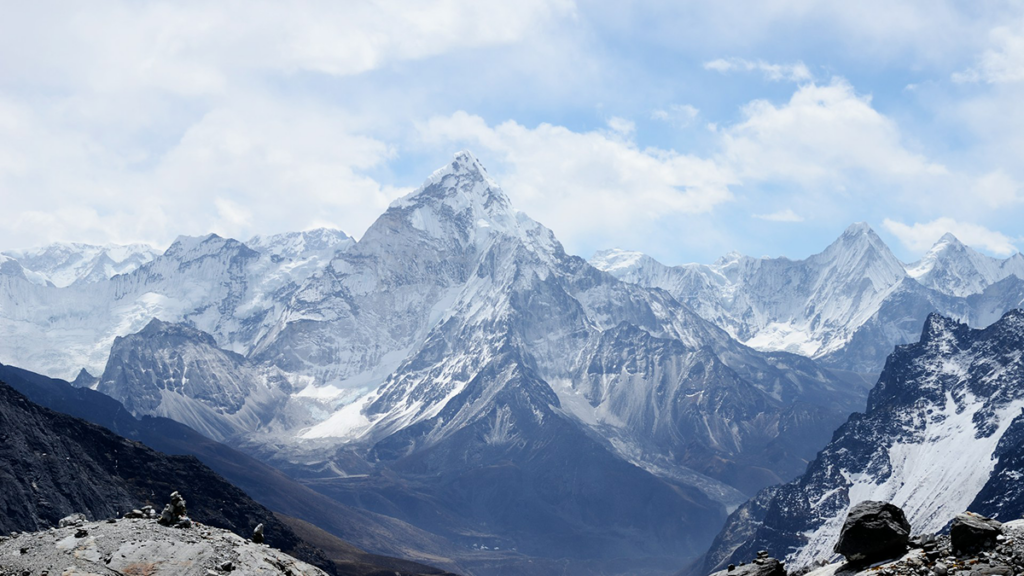
At the center of the discussion lies a fundamental question about one of Earth’s most remarkable geological features: how did the Himalaya and the Tibetan Plateau become the highest and largest mountain system on the planet?

In their paper “Raising the Roof of the World: Intra-Crustal Asian Mantle Supports the
Himalayan–Tibetan Orogen,” Sternai et al. [2025] address this question using numerical geodynamic modeling. These computer simulations reproduce the physical behavior of large rock masses deep inside the Earth and allow researchers to investigate the long-term evolution of this vast orogenic system.

Their study specifically explores the possibility that, during the collision between the Indian and Asian plates, layers of mechanically strong Asian mantle rock became embedded within the thickened Indian continental crust beneath the Tibetan Plateau. According to this hypothesis, these mantle layers could help sustain the elevation of the Plateau by effectively withstanding stresses over long geological timescales: the Indian crust would provide buoyancy (raising the roof), while the Asian mantle would contribute mechanical strength to support the Himalayan–Tibetan topography.

Hetényi and Cattin disagree with and challenge this interpretation in their Comment. Drawing on a large body of well-established geophysical and geological observations, they argue that the structure beneath southern Tibet is better explained by underthrusting, the process by which the Indian plate slides beneath the Tibetan Plateau. Seismic imaging studies, including receiver-function analyses that use earthquake waves to map subsurface structures, consistently reveal features interpreted as Indian crust and upper mantle extending far north beneath Tibet.

In their Reply, Sternai and colleagues clarify that their models were not intended to accurately reproduce the present-day structure of the region in detail. Instead, they were designed as process-oriented experiments to test whether existing and/or alternative mechanisms for crustal thickening and plateau support are mechanically and rheologically viable.

This exchange highlights an important aspect of contemporary geoscience—observations of Earth’s interior such as seismic images, gravity data, and geological records often allow multiple, non-unique interpretations. Numerical modeling provides a complementary approach by evaluating whether proposed geological mechanisms are physically plausible.

Equally significant is the tone of the discussion itself. The Comment and Reply show how scientists, while strongly disagreeing about interpretations, can maintain a constructive and respectful dialogue. Such approach fuels scientific advance by encouraging the community to re-examine established assumptions, refine models, and integrate new observations.

Debates like this one, therefore, extend well beyond a specific geological question. They illustrate how scientific understanding advances through the interplay of observations, theoretical reasoning, and modeling experiments.

In this way, the dialogue highlighted here contributes not only to our understanding of the Himalayan–Tibetan mountain system but also to the broader methodology of Earth science.

Citations

Sternai, P., Pilia, S., Ghelichkhan, S., Bouilhol, P., Menant, A., Davies, D. R., et al. (2025). Raising the roof of the world: Intra-crustal Asian mantle supports the Himalayan-Tibetan orogen. Tectonics, 44, e2025TC009057. https://doi.org/10.1029/2025TC009057

Hetényi, G., & Cattin, R. (2026). Comment on “Raising the roof of the world: Intra-crustal Asian mantle supports the Himalayan-Tibetan orogen” by Sternai et al. Tectonics, 45, e2025TC009214. https://doi.org/10.1029/2025TC009214

Sternai, P., Pilia, S., Ghelichkhan, S., Bouilhol, P., Menant, A., Ostorero, L., et al. (2026). Reply to comment by Hetényi and Cattin on: “Raising the roof of the world: Intra-crustal Asian mantle supports the Himalayan-Tibetan orogen”. Tectonics, 45, e2026TC009436. https://doi.org/10.1029/2026TC009436

—Giulio Viola, Editor-in-Chief, Tectonics

Text © 2026. The authors. CC BY-NC-ND 3.0
Except where otherwise noted, images are subject to copyright. Any reuse without express permission from the copyright owner is prohibited.
  • ✇Eos
  • Pre-Existing Structure and Stress Shape Geothermal-Induced Seismicity Xiaowei Chen
    Editors’ Highlights are summaries of recent papers by AGU’s journal editors. Source: Journal of Geophysical Research: Solid Earth Enhanced Geothermal Systems (EGS) can expand low-carbon energy production, but fluid injection may trigger earthquakes whose locations and mechanisms are difficult to predict. Feng et al. [2026] investigate induced seismicity at China’s first EGS site in the Gonghe Basin using a comprehensive observational dataset. Machine learning processing of data from 20 su
     

Pre-Existing Structure and Stress Shape Geothermal-Induced Seismicity

2 June 2026 at 12:00
Map of the study region and 2 graphs from the study.
Editors’ Highlights are summaries of recent papers by AGU’s journal editors.
Source: Journal of Geophysical Research: Solid Earth

Enhanced Geothermal Systems (EGS) can expand low-carbon energy production, but fluid injection may trigger earthquakes whose locations and mechanisms are difficult to predict. Feng et al. [2026] investigate induced seismicity at China’s first EGS site in the Gonghe Basin using a comprehensive observational dataset. Machine learning processing of data from 20 surface seismic stations produced a high-resolution earthquake catalog with well-constrained locations and focal mechanisms. Stress inversion and modeling, constrained by borehole stress measurements, reveal mechanically weak faults with low friction coefficients, indicating that low-to-moderate fluid overpressure can trigger seismic slip. Site-scale analysis shows that seismicity reflects shear reactivation of pre-existing natural faults, rather than the creation of new tensile fractures. Further integration with borehole image logs reveals a fine-scale relationship between the main seismogenic zones and stress heterogeneity, expressed as rotations of the principal stress axes that likely reflect localized lithological contrasts and fault-damage zones.

Together, these integrated analyses show that geothermal-induced seismicity is controlled by inherited fault architecture at the site scale and localized stress heterogeneity at the borehole scale. By linking seismic observations to borehole stress and image-log evidence, the study provides a more physically constrained framework for seismic-hazard assessment and stimulation design in enhanced geothermal reservoirs.

Citation: Feng, P., Wang, R., Zhang, H., Zhang, C., Schultz, R., & Yang, L. (2026). Pre-existing structures and stress variations jointly control the induced seismicity in enhanced geothermal system of Gonghe Basin, China. Journal of Geophysical Research: Solid Earth, 131, e2025JB033158. https://doi.org/10.1029/2025JB033158  

—Xiaowei Chen, Associate Editor, JGR: Solid Earth

Text © 2026. The authors. CC BY-NC-ND 3.0
Except where otherwise noted, images are subject to copyright. Any reuse without express permission from the copyright owner is prohibited.
  • ✇Eos
  • Let’s Not Forget About Long Droughts Stefan Kollet
    Editors’ Highlights are summaries of recent papers by AGU’s journal editors. Source: Water Resources Research In the March 2026 issue of Water Resources Research, Zhang et al. [2026] interrogate conceptual hydrologic models’ ability to capture prolonged drought dynamics. The Australian Millennium drought serves as an example in the study. The results are quite sobering because the vast majority of more than 40 models fail. Unfortunately, calibration doesn’t generally help either and might
     

Let’s Not Forget About Long Droughts

5 May 2026 at 12:00
Map of the study region with a graph.
Editors’ Highlights are summaries of recent papers by AGU’s journal editors.
Source: Water Resources Research

In the March 2026 issue of Water Resources Research, Zhang et al. [2026] interrogate conceptual hydrologic models’ ability to capture prolonged drought dynamics. The Australian Millennium drought serves as an example in the study. The results are quite sobering because the vast majority of more than 40 models fail. Unfortunately, calibration doesn’t generally help either and might result in massive overfitting. In essence, conceptual models miss deep aquifer storage components and associated hydrodynamic processes leading to a lack of time scales important in drought modeling. The study is a constructive reminder that model parsimony is not necessarily a good thing and that detailed representation of complex physical processes is part of hydrologic sciences.

Citation: Zhang, Z., Fowler, K., & Peel, M. (2026). Can conceptual rainfall-runoff models capture multi-annual storage dynamics? Water Resources Research, 62, e2025WR042226. https://doi.org/10.1029/2025WR042226

—Stefan Kollet, Editor, Water Resources Research

Text © 2026. The authors. CC BY-NC-ND 3.0
Except where otherwise noted, images are subject to copyright. Any reuse without express permission from the copyright owner is prohibited.
  • ✇Eos
  • Drone Imagery Reveals Marked Variability in Antarctic Snow Roughness Elizabeth Orr
    Editors’ Highlights are summaries of recent papers by AGU’s journal editors. Source: Journal of Geophysical Research: Earth Surface Antarctica’s snow and ice surfaces play a key role in how the continent exchanges heat and moisture with the atmosphere. A key property controlling this exchange is aerodynamic roughness length (zo), which measures how “bumpy” the surface is. Rougher surfaces, such as snow sastrugi (wind-formed ridges and grooves), interact more strongly with the air above, a
     

Drone Imagery Reveals Marked Variability in Antarctic Snow Roughness

4 May 2026 at 13:23
Snow drifts.
Editors’ Highlights are summaries of recent papers by AGU’s journal editors.
Source: Journal of Geophysical Research: Earth Surface

Antarctica’s snow and ice surfaces play a key role in how the continent exchanges heat and moisture with the atmosphere. A key property controlling this exchange is aerodynamic roughness length (zo), which measures how “bumpy” the surface is. Rougher surfaces, such as snow sastrugi (wind-formed ridges and grooves), interact more strongly with the air above, affecting snow movement, melting, and local environmental conditions. Despite its importance, zo is often treated as a single, constant value over large areas in Earth system models because it is difficult to measure.

Zheng et al. [2026] use a multi-temporal Unmanned Aerial Vehicle (UAV) oblique photogrammetry to map fine scale zo variability at Qinling Station in East Antarctica. The results show that zo can vary substantially depending on surface type, measurement scale, model choice, and meteorological conditions. The complex response of surface microtopography to meteorological events is a noteworthy new finding. For example, in snow sastrugi areas, zo can vary by an order of magnitude over time, increasing after snowfall and decreasing under strong winds. These findings highlight that capturing fine-scale surface roughness is essential for accurately modeling snow–atmosphere interactions in Antarctica and could help improve current weather and climate models for polar regions.

Citation: Zheng, Z., Zheng, L., Wang, K., Clow, G. D., & Cheng, X. (2026). UAV oblique imagery reveals order-of-magnitude changes in snow aerodynamic roughness length under shifting meteorological regimes at Qinling Station, East Antarctica. Journal of Geophysical Research: Earth Surface, 131, e2025JF008781. https://doi.org/10.1029/2025JF008781

   —Elizabeth Orr, Associate Editor, JGR: Earth Surface

Text © 2026. The authors. CC BY-NC-ND 3.0
Except where otherwise noted, images are subject to copyright. Any reuse without express permission from the copyright owner is prohibited.
  • ✇Eos
  • Managed Agriculture Hinders Predictability of Critical Zone Features Alberto Montanari
    Editors’ Highlights are summaries of recent papers by AGU’s journal editors. Source: AGU Advances The critical zone (CZ) refers to the layer of Earth extending from the bedrock up to the vegetation canopy, including interconnected systems such as river and floodplain corridors, the active soil and root zone, and the near-surface environment where plants interact with the atmosphere. The conservation of the CZ requires a detailed understanding of how it evolves under anthropogenic impacts,
     

Managed Agriculture Hinders Predictability of Critical Zone Features

1 May 2026 at 13:32
Sunrise over a crop field and a small lake.
Editors’ Highlights are summaries of recent papers by AGU’s journal editors.
Source: AGU Advances

The critical zone (CZ) refers to the layer of Earth extending from the bedrock up to the vegetation canopy, including interconnected systems such as river and floodplain corridors, the active soil and root zone, and the near-surface environment where plants interact with the atmosphere. The conservation of the CZ requires a detailed understanding of how it evolves under anthropogenic impacts, such as intensive agriculture.

Goodwell et al. [2026] use a data driven approach to relate shifts in the critical zone to indicators of human impact. Their findings deliver innovative knowledge on transitions, drivers, and predictability in many contexts, and support better prediction and management of the critical zone under environmental change.

In particular, the authors find evidence of abrupt shifts in the variability of key features like stream and soil chemistry, land-atmosphere interaction and so forth, which can be attributed to intensive management, for instance due to mechanized planting and harvesting. These human-impacted and naturally appearing regimes in the dynamics of critical zone have implications for understanding processes and making predictions of the status of the critical zone under environmental change.

Data-driven methods include grouping of time-series data with clustering to detect regimes, dimensionality reduction to simplify system dynamics and identify main sources of variability. Credit: Goodwell et al. [2026], Figure 1

Citation: Goodwell, A. E., Saccardi, B., Dere, A., Druhan, J., Wang, J., Welp, L. R., et al. (2026). Detecting regimes of critical zone processes, drivers and predictability with a data-driven framework. AGU Advances, 7, e2025AV002098. https://doi.org/10.1029/2025AV002098

—Alberto Montanari, Editor-in-Chief, AGU Advances

The logo for the United Nations Sustainable Development Goal 15 is at left. To its right is the following text: The research reported here supports Sustainable Development Goal 15. AGU is committed to supporting the United Nations 2030 Agenda for Sustainable Development, which provides a shared blueprint for peace and prosperity for people and the planet, now and into the future.
Text © 2026. The authors. CC BY-NC-ND 3.0
Except where otherwise noted, images are subject to copyright. Any reuse without express permission from the copyright owner is prohibited.
  • ✇Eos
  • Gravity Waves Help Drive Sediment to the Deep Ocean Chris Micucci
    Editors’ Highlights are summaries of recent papers by AGU’s journal editors. Source: Journal of Geophysical Research: Earth Surface Turbidity currents are underwater currents that transport sediment on the sea floor. They were first observed in the late 1800s in Lake Geneva, Switzerland. The cable break following the 1929 Grand Banks earthquake offshore Canada revealed how massive and destructive these fluxes can be. Turbidity currents move downslope because they have a higher density
     

Gravity Waves Help Drive Sediment to the Deep Ocean

23 April 2026 at 12:00
Photo of the experimental flume used in the study.
Editors’ Highlights are summaries of recent papers by AGU’s journal editors.
Source: Journal of Geophysical Research: Earth Surface

Turbidity currents are underwater currents that transport sediment on the sea floor. They were first observed in the late 1800s in Lake Geneva, Switzerland. The cable break following the 1929 Grand Banks earthquake offshore Canada revealed how massive and destructive these fluxes can be.

Turbidity currents move downslope because they have a higher density than the surrounding water due to the presence of sediment in suspension. It is critical to keep in mind that suspended sediment concentration in these flows is low, meaning that the fluid is Newtonian and the flow is turbulent.

Notwithstanding recent advances in field monitoring, measuring turbidity current thickness, velocity, suspended sediment concentration, and grain size distribution remains difficult not only for the high-water depths and the destructive nature of some events, but also because these flows are often infrequent. Laboratory experiments and mathematical modeling have been used extensively to understand nature and some aspects of these flows, but questions remain on, for example, how turbidity currents interact with ocean waves, if they do.

Daniller-Verghese et al. [2026] performed laboratory experiments to determine if and how turbidity currents interact with ocean gravity waves. Experimental flows were released in an 11-meter-long, 1.2-meter-deep, and 0.61-meter-wide flume in the Experimental Sedimentation Laboratory of the Jackson School of Geoscience at the University of Texas. A motored wave maker was installed at the downstream end of the facility to generate the wave field. During the experiments, detailed velocity measurements were conducted to characterize the flow field and the fine details of the turbulent fluctuations. At the end of each experiment, high-resolution measurements of changes in bed elevations allowed the quantification of the net depositional fluxes.

The results show that, in presence of a superimposed wave field, the center of deposition volume shifted downstream compared to experiments conducted with the same inflow but in absence of waves. In addition, velocity measurements indicate that the wave signal is stronger in presence of turbidity currents compared to the “clear water” case. In other words, current velocity was larger when waves were present, enhancing downslope sediment transport and causing the observed downstream shift of the center of deposition.

Although the physical mechanism responsible for the observed increase of sediment transport rates in presence of a superimposed wave field still needs to be resolved, these results provide novel insight for the interpretation of storm and turbidity current deposits in the rock record. They also highlight the importance of considering wave-turbidity current interactions to constrain sediment budgets on continental shelves, which are essential to preserve and manage coastlines worldwide.

Citation: Daniller-Varghese, M., Smith, E., Mohrig, D., & Myrow, P. (2026). Wave-signal entrainment into combined flows: Consequences for sediment transport, signal dislocation, and turbulence. Journal of Geophysical Research: Earth Surface, 131, e2025JF008497. https://doi.org/10.1029/2025JF008497

—Enrica Viparelli, Associate Editor, JGR: Earth Surface

Text © 2026. The authors. CC BY-NC-ND 3.0
Except where otherwise noted, images are subject to copyright. Any reuse without express permission from the copyright owner is prohibited.
  • ✇Eos
  • More Braided Rivers from Increasing Flow Variability Chris Micucci
    Editors’ Highlights are summaries of recent papers by AGU’s journal editors. Source: AGU Advances The evolution of rivers that split into multiple channels is a scientific challenge in terms of modeling and prediction. On the other hand, these rivers are widespread and play a key role for ecosystems’ life, groundwater recharge, and therefore, water security. They are also extremely sensitive to hydroclimatic changes, leading to shifts in precipitation, erosion and sediment transport. Z
     

More Braided Rivers from Increasing Flow Variability

22 April 2026 at 12:00
Photo of a braided river.
Editors’ Highlights are summaries of recent papers by AGU’s journal editors.
Source: AGU Advances

The evolution of rivers that split into multiple channels is a scientific challenge in terms of modeling and prediction. On the other hand, these rivers are widespread and play a key role for ecosystems’ life, groundwater recharge, and therefore, water security. They are also extremely sensitive to hydroclimatic changes, leading to shifts in precipitation, erosion and sediment transport.

Zhao et al. [2026] investigate the drivers of river evolution for 97 multithread river reaches worldwide, spanning diverse climates and morphologies. The study reveals the key role of intermittency for river evolution. In particular, higher flow intermittency could lead to more even flow partitioning among threads, therefore impacting hydrology and ecosystems. With flow variability increasing after climate change, rivers are likely to increase their thread count, thus impacting livelihoods and ecosystems.

Two example multithread reaches shown in Landsat images from (b) the Irtysh River (wandering) and (c) the Yukon River (braided). Credit: Zhao et al. [2026], Figure 1(b,c)

Citation: Zhao, F., Ganti, V., Chadwick, A., Greenberg, E., McLeod, J., Liu, Y., et al. (2026). Global hydroclimatic controls on multithread River dynamics. AGU Advances, 7, e2025AV002166. https://doi.org/10.1029/2025AV002166

—Alberto Montanari, Editor-in-Chief, AGU Advances

The logo for the United Nations Sustainable Development Goal 13 is at left. To its right is the following text: The research reported here supports Sustainable Development Goal 13. AGU is committed to supporting the United Nations 2030 Agenda for Sustainable Development, which provides a shared blueprint for peace and prosperity for people and the planet, now and into the future.
Text © 2026. The authors. CC BY-NC-ND 3.0
Except where otherwise noted, images are subject to copyright. Any reuse without express permission from the copyright owner is prohibited.
  • ✇Eos
  • Toward Marine Cloud Brightening at Scale: A Science Agenda Ana Barros
    Editors’ Highlights are summaries of recent papers by AGU’s journal editors. Source: AGU Advances The albedo change of marine clouds is achieved by targeted additions of aerosols, and in particular, sea salt. To assess the viability of Marine Cloud Brightening (MCB) requires a fundamental understanding of the impact of aerosols on cloud evolution and properties, and on the cloud environment. Doherty et al. [2026] propose a framework for studying MCB across scales. This includes small-
     

Toward Marine Cloud Brightening at Scale: A Science Agenda

30 April 2026 at 12:00
Clouds above a body of water.
Editors’ Highlights are summaries of recent papers by AGU’s journal editors.
Source: AGU Advances

The albedo change of marine clouds is achieved by targeted additions of aerosols, and in particular, sea salt. To assess the viability of Marine Cloud Brightening (MCB) requires a fundamental understanding of the impact of aerosols on cloud evolution and properties, and on the cloud environment.

Doherty et al. [2026] propose a framework for studying MCB across scales. This includes small- to large-scale studies aimed at systematically characterizing the life-cycle of aerosols and the diurnal cycle of cloud processes, how these change with the magnitude, duration and type of aerosol applied, and monitoring potential harmful direct or indirect consequences of aerosol injection, such as regional changes in temperature or precipitation.

Possible configuration for a Stage III study for measuring local scale cloud responses to a single plume of generated sea salt aerosol sized for marine cloud brightening. Credit: Doherty et al. [2026], Figure 4

Citation: Doherty, S. J., Diamond, M. S., Wood, R., & Hirasawa, H. (2026). Defining scales of field studies and experiments to assess marine cloud brightening. AGU Advances,7, e2025AV001939. https://doi.org/10.1029/2025AV001939

—Ana P. Barros, Editor, AGU Advances

The logo for the United Nations Sustainable Development Goal 13 is at left. To its right is the following text: The research reported here supports Sustainable Development Goal 13. AGU is committed to supporting the United Nations 2030 Agenda for Sustainable Development, which provides a shared blueprint for peace and prosperity for people and the planet, now and into the future.
Text © 2026. The authors. CC BY-NC-ND 3.0
Except where otherwise noted, images are subject to copyright. Any reuse without express permission from the copyright owner is prohibited.
  • ✇Eos
  • Weather Radar Data Reveal the Dynamics of Rapidly Spreading Wildfires William J. Randel
    Editors’ Highlights are summaries of recent papers by AGU’s journal editors. Source: Journal of Geophysical Research: Atmospheres The 2018 Camp Fire was the deadliest and most destructive wildfire in California history. The Camp Fire spread extremely rapidly, driven by strong winds and dry fuels, but also by organized long-range spotting, i.e. lofting and downwind fallout of burning embers to ignite new fires. Using operational Doppler radar and satellite observations, Lareau [2026] pr
     

Weather Radar Data Reveal the Dynamics of Rapidly Spreading Wildfires

21 April 2026 at 12:00
Aerial photo of smoke billowing from a wildfire.
Editors’ Highlights are summaries of recent papers by AGU’s journal editors.
Source: Journal of Geophysical Research: Atmospheres

The 2018 Camp Fire was the deadliest and most destructive wildfire in California history. The Camp Fire spread extremely rapidly, driven by strong winds and dry fuels, but also by organized long-range spotting, i.e. lofting and downwind fallout of burning embers to ignite new fires.

Using operational Doppler radar and satellite observations, Lareau [2026] provides the first high resolution depiction of spotting behavior during an extreme wildfire. Observations show that spot fire events for the Camp Fire occurred 5-10 kilometers ahead of the fire front, quickly merging into new fire lines. Spot fires are not random but aligned within coherent fallout zones that are shaped by plume dynamics and background winds. These results show that operational weather radar can identify lofting and fallout regions in real time, providing a new way to anticipate spotting-driven fire spread and improve early warnings for fast-moving wildfires.

(a) Along wind cross section of Camp Fire plume reflectivity observed by radar measurements, showing distinct updrafts (white arrows) and ashfall regions (blue dashed arrow). Spot fires within 10 minutes of these radar measurements are shown as filled cyan triangles. (b) Map of column maximum radar reflectivity and fire perimeter. In both panels the black dashed line indicates the eastern edge of the town of Paradise, California. Credit: Lareau [2026], Figure 6ab

Citation: Lareau, N. P. (2026). Plume-coupled long-range spotting drove the explosive spread of the 2018 Camp Fire. Journal of Geophysical Research: Atmospheres, 131, e2025JD045798. https://doi.org/10.1029/2025JD045798

—William Randel, Editor, JGR: Atmospheres

The logo for the United Nations Sustainable Development Goal 13 is at left. To its right is the following text: The research reported here supports Sustainable Development Goal 13. AGU is committed to supporting the United Nations 2030 Agenda for Sustainable Development, which provides a shared blueprint for peace and prosperity for people and the planet, now and into the future.
Text © 2026. The authors. CC BY-NC-ND 3.0
Except where otherwise noted, images are subject to copyright. Any reuse without express permission from the copyright owner is prohibited.
  • ✇Eos
  • From Grains to Bands: Modeling Deformation in Porous Rocks François Renard
    Editors’ Highlights are summaries of recent papers by AGU’s journal editors. Source: Journal of Geophysical Research: Solid Earth Highly porous rocks, such as sandstones, often deform in a surprising way: instead of breaking apart or sliding, they develop thin zones called deformation bands. In these bands, the grains are squeezed closer together, making the rock denser, and reducing how easily fluids such as water or oil can move through it. This behavior is important because it affects
     

From Grains to Bands: Modeling Deformation in Porous Rocks

26 May 2026 at 12:00
Photo of a rock outcrop.
Editors’ Highlights are summaries of recent papers by AGU’s journal editors.
Source: Journal of Geophysical Research: Solid Earth

Highly porous rocks, such as sandstones, often deform in a surprising way: instead of breaking apart or sliding, they develop thin zones called deformation bands. In these bands, the grains are squeezed closer together, making the rock denser, and reducing how easily fluids such as water or oil can move through it. This behavior is important because it affects both the strength of rocks and their ability to store and transport fluids underground. However, these bands are difficult to model because they form suddenly from an initially uniform material and concentrate deformation into very narrow zones.

Wang et al. [2026] developed a computer modeling approach called a “phase‑field model” to study this process. Instead of drawing the bands in the initially homogeneous rock, the model allows them to appear naturally as the system evolves and minimizes its energy. The study shows how grain crushing and rearrangement allows the formation of localized deformation zones. The results also demonstrate that natural spatial variations in the rock, such as differences in grain size or porosity, strongly influence where bands initiate and how they grow. Additionally, the model captures how deformation changes from sliding (shear bands) to pure compaction as pressure increases. Overall, this work provides a realistic way to understand how localized deformation develops in rocks, with important implications for geology, engineering, and energy applications.

Citation: Wang, Y., Zhang, C., Braun, P., Kang, X., & Wu, W. (2026). How does heterogeneity control strain localization patterns in high-porosity rocks? Journal of Geophysical Research: Solid Earth, 131, e2025JB032494. https://doi.org/10.1029/2025JB032494

—François Renard, Associate Editor, JGR: Solid Earth

Text © 2026. The authors. CC BY-NC-ND 3.0
Except where otherwise noted, images are subject to copyright. Any reuse without express permission from the copyright owner is prohibited.
  • ✇Eos
  • Small and Large Grains Move Differently in Water Eric Parteli
    Editors’ Highlights are summaries of recent papers by AGU’s journal editors. Source: Journal of Geophysical Research: Earth Surface Sediment transport shapes the Earth surface in different ways, by forming desert dunes and by sculpting the topography of rivers, but the physics of sediment transport initiation is still incompletely understood. For decades, models have generally assumed two basic entrainment mechanisms: a grain resting on the sediment bed is either lifted directly by fluid
     

Small and Large Grains Move Differently in Water

18 May 2026 at 14:24
Diagram and photo of the experimental setup.
Editors’ Highlights are summaries of recent papers by AGU’s journal editors.
Source: Journal of Geophysical Research: Earth Surface

Sediment transport shapes the Earth surface in different ways, by forming desert dunes and by sculpting the topography of rivers, but the physics of sediment transport initiation is still incompletely understood. For decades, models have generally assumed two basic entrainment mechanisms: a grain resting on the sediment bed is either lifted directly by fluid forces, or it is emitted from the soil indirectly, as product of a granular splash caused by the heavy impact of another grain.

However, recent breakthroughs in grain-based simulations and high-speed visualization have been offering a much clearer look at the processes that trigger grain motion. Insights from these recent advances have revealed a rather broad spectrum of indirect particle-particle and particle-fluid interactions driving entrainment, including the rearrangement of surface grains after splash and changes in near‐bed flow structure due to moving grains. These interactions exert non-local influences on transport thresholds, giving rise to a dynamic process known as collective particle entrainment—a mechanism that remains poorly understood at a fundamental level.

In a new study, Chartrand [2026] shows that collective particle entrainment is size-dependent: large grains interact primarily with their peers, while smaller grains are mobilized by both large and similar-sized particles. This distinction leads to divergent transport signatures, with a new stochastic model predicting temporally correlated motion for small grains and uncorrelated, white-noise entrainment statistics for larger particles.

Although theoretical modeling will be required to shed further light on the physics of collective entrainment, the author’s study is a step toward a quantitative model of sediment transport from a probabilistic perspective. Looking ahead, Chartrand’s ideas could now be extended to other environments, potentially transforming our understanding of entrainment in other contexts such as wind-blown transport and extraterrestrial atmospheric processes.

Citation: Chartrand, S. M. (2026). Collective particle entrainment explored with experimental data and coupled transfer functions. Journal of Geophysical Research: Earth Surface, 131, e2025JF008657. https://doi.org/10.1029/2025JF008657

—Eric Parteli, Associate Editor, JGR: Earth Surface

Text © 2026. The authors. CC BY-NC-ND 3.0
Except where otherwise noted, images are subject to copyright. Any reuse without express permission from the copyright owner is prohibited.
  • ✇Eos
  • Recycled Rocks Reveal Subduction Zone Dynamics Off Baja California Alexis Ault
    Editors’ Highlights are summaries of recent papers by AGU’s journal editors. Source: Tectonics At subduction zones, one tectonic plate dives beneath another, dragging rocks tens of kilometers into Earth’s interior where they are transformed by extreme pressures and temperatures. Some of these deeply buried rocks make it back to the surface, carrying a record of conditions along the plate boundary at depth. Geologists have long debated how these high-pressure rocks are exhumed and how they
     

Recycled Rocks Reveal Subduction Zone Dynamics Off Baja California

21 May 2026 at 13:53
Photo of a rocky landscape with labels for geologic features.
Editors’ Highlights are summaries of recent papers by AGU’s journal editors.
Source: Tectonics

At subduction zones, one tectonic plate dives beneath another, dragging rocks tens of kilometers into Earth’s interior where they are transformed by extreme pressures and temperatures. Some of these deeply buried rocks make it back to the surface, carrying a record of conditions along the plate boundary at depth. Geologists have long debated how these high-pressure rocks are exhumed and how they end up mixed into younger, lower-grade surrounding material.

Wang et al. [2026] address this question with detailed geologic mapping, Ar-Ar analyses, and U-Pb geochronology from subduction complex rocks on Cedros Island, offshore Baja California, Mexico. Their data show that high-pressure blocks yield cooling ages between 172 and 144 million years old, yet they are hosted in sedimentary rocks no older than about 92 million years. This age mismatch, combined with field evidence that the blocks are enveloped in sedimentary matrix rather than tectonically sheared into place, leads the authors to propose that the high-pressure rocks were exhumed to the surface, eroded, and recycled back into the subduction trench as sedimentary debris, potentially multiple times. The authors suggest that rapid exhumation was driven by extension within the forearc wedge. When plate convergence rates dropped abruptly, the wedge became gravitationally unstable and stretched along brittle-ductile shear zones, bringing deeply buried rocks to shallow crustal levels.

This polycyclic model is incompatible with alternative interpretations in which exotic blocks were mixed into their host matrix by viscous return flow within the subduction channel, because such models predict that blocks and their surrounding matrix should share similar thermal histories. Instead, the data require that blocks completed their journey to depth and back long before the surrounding sediments even entered the trench. The new understanding of subduction dynamics on Cedros Islands illuminates connections with the broader Franciscan Complex of California, where the origin of similar high-pressure blocks in younger matrix has been debated for decades. Together, these findings offer new perspectives on how subduction zones operate over long timescales and how their fragmentary rock record preserves fundamental evidence of the tectonic history of the continental margin. 

Citation: Wang, J. W., Kapp, P., Holder, R., He, J., Hernández-Uribe, D., & Worthington, J. (2026). Polycyclic metamorphism, exhumation, and recycling of subduction complex rocks, Cedros Island, Baja California. Tectonics, 45, e2025TC009340. https://doi.org/10.1029/2025TC009340

­­—Alexis Ault, Associate Editor, Tectonics

Text © 2026. The authors. CC BY-NC-ND 3.0
Except where otherwise noted, images are subject to copyright. Any reuse without express permission from the copyright owner is prohibited.
❌
Subscriptions