Reading view

Seismic Attenuation Techniques Reveal What Lies Beneath Taiwan

Three researchers huddle around camping equipment and scientific instruments in a grassy area on a foggy day.
Source: Geophysical Research Letters

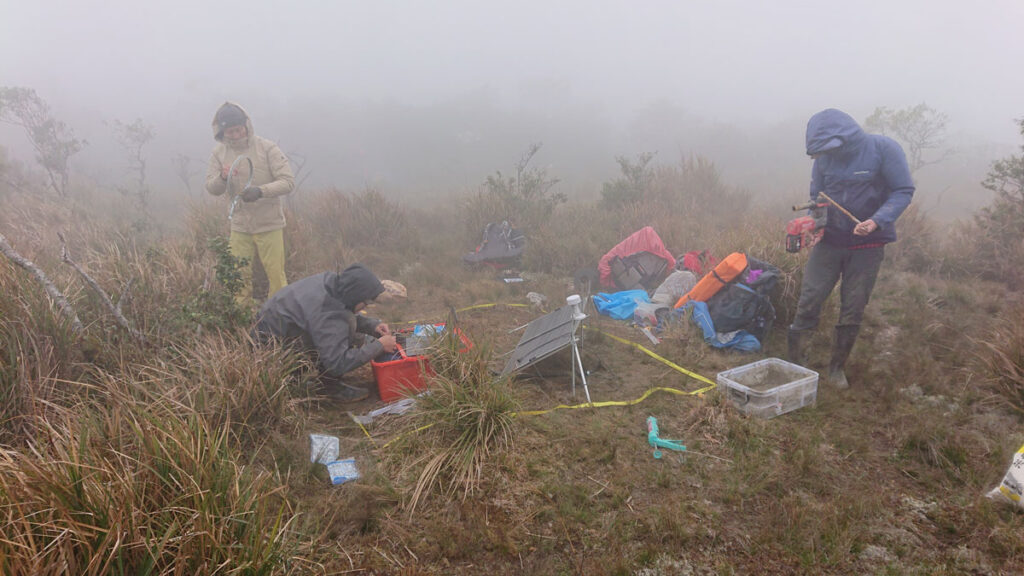
As seismic waves travel through Earth, they gradually lose energy, a process called attenuation. That energy loss doesn’t happen uniformly—some features in the crust sap far more energy from seismic waves than others. Researchers can map underground features by watching where seismic waves lose more or less energy. The Southern Array for the Lithosphere and Uplift of Taiwan Experiment (SALUTE) is doing just that, providing information that could lead to improved seismic hazard planning in the country.

Lin et al. report attenuation results from SALUTE focused on the convergence between the Eurasian plate and the Luzon Arc, an understudied, geologically dynamic area where Earth’s crust is deforming. Using the overall attenuation rate and relative attenuation rates of P and S seismic waves, the authors imaged active faults, identified distinct lithologies, and better resolved the Luzon forearc block that sits just offshore of Taiwan.

The authors used data from the SALUTE high-density seismographic network, spanning December 2020 to December 2023, to construct both 2D and 3D attenuation models. They found clear changes in attenuation associated with major faults, as well as areas of high attenuation associated with fluid-rich, ductile zones in the lower crust that cause tectonic tremors. Their attenuation imaging additionally revealed that the Luzon forearc block, which had been poorly imaged in the past, dips northward and narrows as it nears the convergence zone.

The authors say their results agree well with previous velocity-based seismic imaging studies and show that attenuation can image features, such as transition zones, that were previously difficult to capture. Their data could also be useful for better understanding seismic hazard throughout the region, they note. (Geophysical Research Letters, https://doi.org/10.1029/2025GL121583, 2026)

—Nathaniel Scharping (@nathanielscharp), Science Writer

A photo of a telescope array appears in a circle over a field of blue along with the Eos logo and the following text: Support Eos’s mission to broadly share science news and research. Below the text is a darker blue button that reads “donate today.”
Citation: Scharping, N. (2026), Seismic attenuation techniques reveal what lies beneath Taiwan, Eos, 107, https://doi.org/10.1029/2026EO260150. Published on 11 May 2026.
Text © 2026. AGU. CC BY-NC-ND 3.0
Except where otherwise noted, images are subject to copyright. Any reuse without express permission from the copyright owner is prohibited.
  •  

How Wildfires Worsen Flood Risk

A rocky stream flows through a landscape of burned trees. A mountain is visible in the background.
Source: Water Resources Research

Wildfires can increase flooding risks in and downstream of burned areas by removing vegetation and disturbing hydrologic processes. As the climate changes, the severity of both wildfires and heavy rainfall events is increasing, meaning flooding is likely to become more severe in the near future. Better understanding how, and by how much, wildfires change flood risk is important for disaster and infrastructure planning for communities around the country.

Canham and Lane used streamflow data from the U.S. Geological Survey’s National Water Information System and precipitation data from the NOAA Analysis of Record for Calibration product to identify storms and quantify their effects across seven burned watersheds in the western United States.

To make the most of the limited data on flooding in the years following wildfires, the researchers created a paired-storms framework: They identified postfire peak flows (PFPFs), defined as the five highest peak flows within 3 years of a wildfire across seven watersheds. Then, for each precipitation event causing a PFPF, they looked for storms with similar characteristics (or paired storms) that occurred before the wildfire. Storm characteristics used for pairing included the season in which the storm occurred, recent precipitation, and precipitation depth, duration, and peak intensity.

The researchers found significantly elevated peak flows after wildfires in many cases, underlining the risks to communities following wildfires and validating their approach for use elsewhere.

Altogether, the authors found 26 PFPF events, including 20 with paired storms occurring before wildfires. For 75% of the postfire storms, their peak flows were 2 or more times greater than prefire peak flows. PFPFs were most likely to happen in the first year after a wildfire and typically occurred following storms that were centered upstream of the watershed centroid, were uniform in shape, and fully covered the watershed and burned area, the authors reported. They also found some evidence that the first storm in the year immediately following a fire has a higher-than-expected chance of producing a PFPF.

Future work could look more deeply at the characteristics of storms occurring over burned areas, such as storm direction and watershed recovery, and could apply the automated methods to more burned watersheds and storm events to enhance the robustness of the work, the authors say. (Water Resources Research, https://doi.org/10.1029/2025WR040693, 2026)

—Nathaniel Scharping (@nathanielscharp), Science Writer

A photo of a telescope array appears in a circle over a field of blue along with the Eos logo and the following text: Support Eos’s mission to broadly share science news and research. Below the text is a darker blue button that reads “donate today.”
Citation: Scharping, N. (2026), How wildfires worsen flood risk, Eos, 107, https://doi.org/10.1029/2026EO260133. Published on 30 April 2026.
Text © 2026. AGU. CC BY-NC-ND 3.0
Except where otherwise noted, images are subject to copyright. Any reuse without express permission from the copyright owner is prohibited.
  •  

Eddy or Not: Do Eddies Actually Transport That Much Carbon?

A satellite image of the ocean shows various shades of blue swirls.
Source: Global Biogeochemical Cycles

The biological carbon pump moves carbon from near the ocean’s surface to deeper regions, maintaining the upper ocean’s ability to absorb carbon from the atmosphere. One component of this system is driven by eddies, or relatively small-scale circular water currents powered by physical instabilities within the ocean. Previous estimates have suggested the eddy subduction pump may play a large role in moving carbon deep into the ocean, but the absence of global synthesis leaves the question open.

With data from a worldwide network of remote sensors, Keutgen De Greef et al. captured the eddy subduction pump in action around the globe. Their analysis shows that this pump carries less than 5% of the overall organic carbon transported by the biological carbon pump, meaning it’s of secondary importance to understanding ocean carbon flows.

The authors used data spanning 2010 to 2024 from 941 Argo floats drifting autonomously around the globe. They found 1,333 eddy subduction events below 200 meters. Adding up the contribution of a subset of these they identified as carbon subduction events, they estimated the eddy subduction pump exports 0.05 petagram (~50 million metric tons) of carbon per year from the ocean surface. Carbon subduction hot spots exist at mid- to high latitudes in the Southern Ocean and subpolar North Atlantic, both of which also exhibited a strong seasonal peak in spring. The authors also noted a correlation between eddy kinetic energy and physical subduction events (when surface waters sink below the mixed layer), providing insights into the mechanisms driving the eddy subduction pump

The study comes with some limitations, including the sparsity of data in ocean regions including much of the Pacific, the South Atlantic, and the southern Indian Ocean, which could lead to those regions’ contributions being underestimated. The Argo floats measure particulate carbon levels but are unable to effectively measure dissolved organic carbon, meaning some carbon export is being missed. But given the minimal contribution of the eddy subduction pump, these factors may not significantly change estimates of overall biological carbon subduction, the authors suggest. (Global Biogeochemical Cycles, https://doi.org/10.1029/2025GB008912, 2026)

—Nathaniel Scharping (@nathanielscharp), Science Writer

A photo of a telescope array appears in a circle over a field of blue along with the Eos logo and the following text: Support Eos’s mission to broadly share science news and research. Below the text is a darker blue button that reads “donate today.”
Citation: Scharping, N. (2026), Eddy or not: Do eddies actually transport that much carbon?, Eos, 107, https://doi.org/10.1029/2026EO260119. Published on 17 April 2026.
Text © 2026. AGU. CC BY-NC-ND 3.0
Except where otherwise noted, images are subject to copyright. Any reuse without express permission from the copyright owner is prohibited.
  •  

哪些国家因颗粒物空气污染付出的代价最大?

两座烟囱矗立在一片浓重的烟雾之中,而这些烟雾几乎完全遮蔽了城市的景色。
Source: GeoHealth

This is an authorized translation of an Eos article. 本文是Eos文章的授权翻译。

世界卫生组织的数据,全球每年因空气污染导致的死亡人数估计达 700 万。其中大部分死亡病例是由PM2.5引起的,这种直径小于 2.5 微米的颗粒物能够进入肺部和血液,从而引发呼吸系统和心血管系统疾病。除了直接排放到大气中的颗粒物外,工厂、船只、汽车和发电厂排放的氨(NH3)、氮氧化物(NOX)和二氧化硫(SO2)等物质也是导致 PM2.5 形成的前体物。然而,颗粒物污染的影响并非均匀分布。

Oztaner等人对北半球各区域的空气污染后果进行了建模,从而更细致地分析了哪些地区的减排政策最为有效。他们利用美国环保署(EPA)社区多尺度空气质量(CMAQ)建模平台的多相伴随模型(multiphase adjoint model),从挽救生命和节省资金两个角度评估了减少各种污染物带来的效益。该研究通过国际机构所广泛采用的一种成熟方法,计算出了空气污染影响所造成的经济损失。不过,这种方法也引发了一些伦理方面的担忧,因为它在评估生命价值时部分地依据了各国的人均国内生产总值(GDP)。

总体而言,研究发现,如果所有模型中的排放量减少 10%,那么在北半球每年将能挽救 513,700 人的生命,并节省 1.2 万亿美元的费用。

死亡率降幅最大的是中国和印度,削减排放量每年将分别挽救184,000人和124,000人的生命。成本节约幅度最大的也是中国,其次是欧洲和北美。健康效益也因排放类型和行业而异。氨(NH3)在中国造成的危害更大,而氮氧化物(NOx)在欧洲的危害相对高于其他地区。在整个北半球,农业部门是颗粒物和前体物污染的主要来源,预计农业相关排放量减少10%可挽救95,000人的生命,并节省约2900亿美元。其次是居民区和工业区。

作者指出,在对类似研究的结果进行比较时应保持谨慎,一部分原因是污染物浓度与健康结果之间的关联并非总是呈线性关系,还有一部分原因是不同地区在核算各行业排放量时可能采用不同的方法。此外,他们的研究仅关注与 PM2.5 相关的死亡率,未考虑如臭氧等其他污染物。总体而言,他们认为他们的研究为比较北半球不同污染物减排策略的效果提供了一个有意义的参考。(GeoHealth, https://doi.org/10.1029/2025GH001533, 2026)

—科学撰稿人Nathaniel Scharping (@nathanielscharp)

This translation was made by Wiley本文翻译由Wiley提供。

Read this article on WeChat. 在微信上阅读本文。

A photo of a telescope array appears in a circle over a field of blue along with the Eos logo and the following text: Support Eos’s mission to broadly share science news and research. Below the text is a darker blue button that reads “donate today.”
Text © 2026. AGU. CC BY-NC-ND 3.0
Except where otherwise noted, images are subject to copyright. Any reuse without express permission from the copyright owner is prohibited.
  •  
❌